Exploring Dowth, House of Darkness, Entrance To The Otherworld

Dowth is one of the three main tombs of the Brú na Bóinne World Heritage Site – a landscape of prehistoric monuments including the large passage-tombs at nearby Newgrange and Knowth.

Dowth, Knowth and Newgrange are actually all part of single ancient ritual landscape, rather than separate sites.

Unlike Newgrange and Knowth, Dowth has not been independently dated and has not undergone extensive restoration.

Dowth is less developed as a tourist attraction than Knowth and Newgrange, partly because the site has been damaged by centuries of looters, plundered by Vikings, and had stones taken by quarrying. Ill-advised archeological work in the 19th century included the Royal Irish Academy dynamiting the roof, causing a large still visible crater.

Dowth is set in a spectacular location on the highest point in the Boyne Valley. Newgrange, 2 kilometers distant, is visible from Dowth.

Dowth’s mound is approximately 15 meters high and 85 meters in diameter. It one of the largest and oldest megalithic structures in Ireland, larger than Newgrange.
http://www.carrowkeel.com/sites/boyne/dowth1.html

White quartz stones found around the base of the Dowth mound indicate it may once have had a bright white exterior wall like Newgrange.

Dowth was once surrounded by 115 kerbstones. Kerbstone 51, known as the Stone of the Seven Suns, features a number of radial circular carvings. A kerbstone with cup-marks and a spiral and a flower-like design, marks the entrance to Dowth South.

Three stone-lined passages lead into the mound. There are two passage tombs, known as Dowth North and Dowth South, and a souterrain. A third entrance on Dowth’s west side of is an early Christian souterrain that leads into the passage of Dowth North. It was built during the 10th or 11th century CE.

Like the other Boyne Valley passage tombs, Dowth has a rich mythological history.

According to one legend, Dowth is the burial place of the goddess Boann. Boann was said to have created the River Boyne.

Dowth was also believed to be the entrance to the Otherworld, a magical realm that was home to the Tuatha Dé Danann, mythical gods who lived in Ireland before humans.

In legendary lore, Dowth is called the Fairy Mound of Darkness, Dubhadh (‘darkening’), and The House of Darkness.

The medieval Dindsenchas (lore of places) says that king Bresal Bó-Díbad ordered the construction of a tower in a single day to reach heaven. Bersal’s sister cast a spell, making the sun stand still so that one day lasted indefinitely. Bresal then committed incest with his sister, breaking the spell, a legend similar to one associated with Newgrange.

With the spell broken, the sun sets and the builders leave. Hence the name Dubhadh (‘darkening’).

There may be a kernel of fact in the incest myth. Recent DNA analysis of human remains of a man at found Newgrange revealed he had parents who were most likely siblings.

These tales of light and darkness have been linked with solstice alignments at Brú na Bóinne.

Dowth’s tombs have winter solstice solar alignments like Newgrange.

Martin Brennan, author of The Stars and the Stones: Ancient Art and Astronomy in discovered the alignment during a ten-year study of the Boyne Valley.

From November to February light from the evening sun reaches into the Dowth South tomb passage and into the chamber. During the winter solstice, the sun light moves along the passage, into the circular chamber, where three stones are lit up by the sun.
https://www.knowth.com/dowth-sunsets.htm

Music:
Newgrange, RDScally & the Obstweedles, from the album Entropy: The Last Word In Everything
Available on Bandcamp
https://obstweedles.bandcamp.com/track/newgrange
ASCAP: QZ-6V5-16-00148 Published by Wounded Weasel Music Copyright 2019

Clouds Obscura, RDScally & the Obstweedles, from the album Entropy: The Last Word In Everything
Available on Bandcamp https://obstweedles.bandcamp.com/track/clouds-obscura
ASCAP: QZ-6V5-16-00156 Published by Wounded Weasel Music Copyright 2019

Entropy: The Last Word In Everything
https://obstweedles.bandcamp.com/album/entropy-the-last-word-in-everything
Published by Wounded Weasel Music Copyright 2019

#Dowth #ireland #irish #irishhistory #ancientireland #countymeath #passagetomb #archeology #irisharcheology #newgrange #knowth #ireland_travel #megalithic #kerbstone #runes

The Marvels And Mysteries Of Newgrange, County Meath, Ireland

The passage tomb at Newgrange is Ireland’s most famous megalithic monument.

Newgrange, located on hillside overlooking the River Boyne, 8 kilometers (5.0 mi) west of Drogheda, is a passage tomb built during the Neolithic Period, around 3200 BC. It is older than Stonehenge and the Egyptian pyramids.

Newgrange is the main monument in the Brú na Bóinne complex, a World Heritage Site that includes the nearby passage tombs of Knowth and Dowth, as well as other henges, burial mounds and standing stones.

Newgrange consists of a large circular mound with an inner stone passageway that leads to a cruciform chamber. Burnt and unburnt human bones, and possible grave goods or votive offerings, were found in this chamber.

The mound has a retaining wall at the front, made mostly of white quartz cobblestones. It is encircled by kerbstones, with many of the stones engraved in megalithic art. The mound is also ringed by a stone circle.

Some of the material that makes up the monument came from as far as the Mournes and Wicklow Mountains.

There is no agreement about the Newgrange tomb’s purpose, but it is believed it had religious significance.

It is aligned on the winter solstice sunrise so that the rising sun shines through a ‘roofbox’ above the entrance and floods the inner chamber with sunlight.

The engineering and construction of the roofbox and tomb indicates a highly sophisticated ancient culture existed in Boyne River valley.

Archeologists disagree about the construction of the Newgrange tomb.

Irish geologist and naturalist Frank Mitchell, who studied Newgrange, suggested that it could have been built in as little as five years. His estimate was based on the likely number of local inhabitants during the Neolithic age and the amount of time they could have devoted to building it rather than farming.

Mitchell’s estimate, however, was challenged by archeologist Michael J. O’Kelly and his archaeological team, who believed that it would have taken a minimum of thirty years to build.

DNA analysis revealed that bones found in the most chamber belonged to a man whose parents were first-degree relatives, possibly brother and sister. Such inbreeding was usually only found in royal dynasties headed by ‘god-kings’, such as the pharaohs of ancient Egypt, who married among themselves to keep the royal bloodline ‘pure’. The man was distantly related to people buried in the Carrowkeel and Carrowmore tombs.

This, together with the prestige of the burial, could mean that an elite group was responsible for building Newgrange.

The largely unknown Boyne valley culture used the site for about 1,000 years. The site then feel into ruins but area remained in use by the Beaker Culture, another group that replaced the culture that built the passage tomb, into the Bronze Age.

During the Bronze Age large timber circle (or henge) was constructed to the southeast of the main mound and a smaller timber circle to the west.

Newgrange evidently continued to have some ritual significance into the Iron Age. Some of the objects deposited around the mound include two pendants made from gold Roman coins of 320–337 and Roman-era gold jewelry including two bracelets, two finger rings, and a necklace. These Roman finds are interesting since the Romans did not occupy Ireland as they did Brittan and never had a long-term presence in Ireland.

Music Used in this Video:
Artist: RDScally and the Obstweedles
Song: Gardening With Candide
https://obstweedles.bandcamp.com/album/gardening-with-candide-the-optimist-grows-it-alone-jardiner-avec-candide
Album: Gardening With Candide
QZ-6V5-16-00175 ASCAP
Copyright 2020 RDScally / Wounded Weasel Publishing
Available from Bandcamp
https://obstweedles.bandcamp.com/track/gardening-with-candide

#ireland #newgrange #passagetomb #irish #irishhistory #ancient #ancientireland #countymeath #riverboyne #boynevalley #history #prehistoric #prehistoricireland #megalithic #megalithicireland #archeology #kerbstone #ritual #mysterious #bronzeage #henge #standingstone #stonecircle #neolithic #neolithicage #runes #wintersolstice #megalithicart

The Fascinating Castles of County Louth. Ireland

County Louth has a wealth of historic castles.

Many of these castles are historic ruins, but a few have been restored and are still in use.

At least three County Louth castles – Belllingham Castle, Darver Castle and Slane Castle – are wedding and event venues. Another – Smarmore Castle – is a drug and alcohol dependency treatment facility. Ardee Castle houses municipal government offices.

A few castles, such as Castle Roche, are on private land. Others, such as Carlingford (King John’s) Castle, The Mint in Carlingford and Roodstown Castle, are designated Irish national monuments.

This video covers just some of Louth’s prominent castles and isn’t comprehensive.

A full listing of Louth’s castles:
Rootsweb.com The Castles of Ireland
https://sites.rootsweb.com/~irlkik/ihm/castles/irecastl-Louth.htm

#ireland #irish #irishhistory #irishcastle #louth #countylouth #history #castles #irishcastles #carlingford #cúchulainn #roodstown #ardee #irishcastles #castleroche #carlingfordcastle #middleages #medieval #medievalreland #englishhistory #england #thepale

The Majestic Ruin of Castle Roche

Castle Roche is a Norman castle was the seat of the de Verdun family who built the castle in 1236 AD. [1]

Located 10 km (7 miles) northwest of Dundalk, County Louth, Ireland, Castle Roche is located on a large and steep-sided rocky outcrop with a commanding view of the surrounding area.

A deep moat and thick walls rendered it virtually impregnable. A secret passage may have once connected the castle to a round tower outpost.

The castle’s layout is nearly triangular with a large central courtyard inside the walls. A bailey separated from the castle to the north controlled entrance to the castle and the bridge between its two large bastion towers.

Although ruined the internal layout of the castle is visible, with a two- or three-story hall in the south sections along with remains other structures.

Castle Roche held a strategic position on the border between the then Gaelic province of Ulster, and the Anglo-Norman territory known as The Pale. The castle controlled the pass into what is now South Armagh.

Castle Roche was known as ‘Castellum de Rupe’ or ‘Castle on the Rock’ due to its strategic location. The de Verdun family owned the site for four centuries. Nicholas de Verdun (who died in 1316), a younger brother of Theobald II de Verdun, was in charge during the Bruce Invasion by Edward Bruce, brother of Robert the Bruce.

A gathering of English forces in Ireland took place here in 1561. The castle was ruined in 1641, during the Oliver Cromwell’s conquest of Ireland.

A Guide (With Warnings) For Visiting Castle Roche Near Dundalk https://www.theirishroadtrip.com/cast… Sources and credits: De Verdun family history https://web.archive.org/web/201603031… Castle Roche photo Creative Commons, by Hazazzy, uploaded 6 April 2010. The Majestic Ruin of Castle Roche

Exploring King John’s Castle, Carlingford, County Louth, Ireland

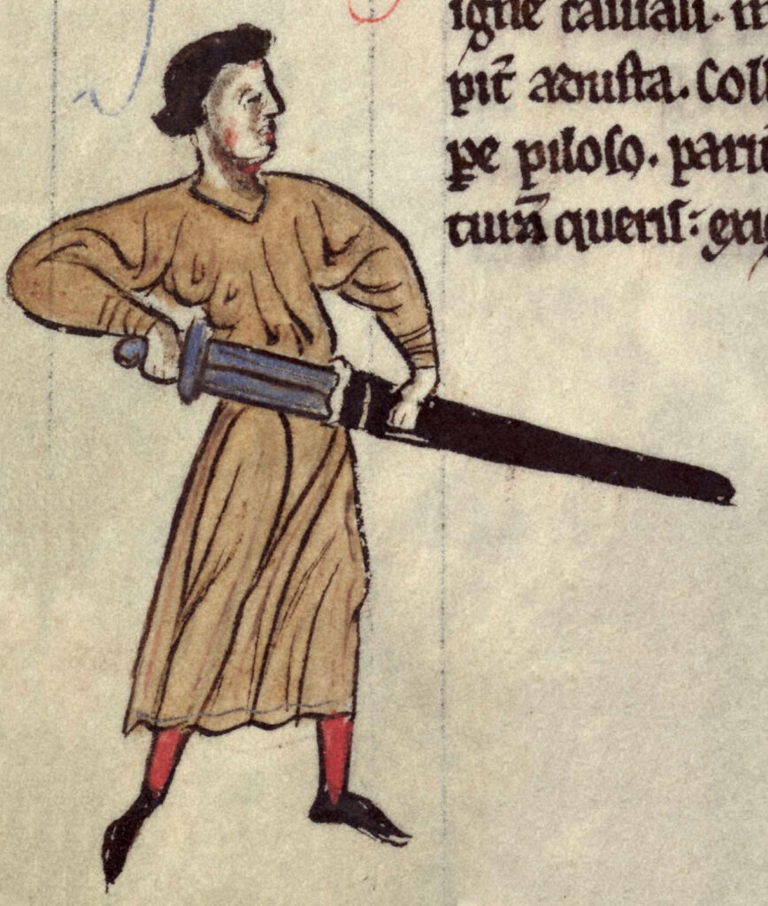
Drawing of de Lacy by Gerald of Wales

King John’s Castle, also known as Carlingford Castle, played a role in 500 years of Irish history from medieval times to the Battle of the Boyne.

Carlingford Castle is located in a strategic position on a high rocky outcrop point above Carlingford’s harbor on the south side of Carlingford Lough.

The original section of the castle, its west wing, was built in the late 12th century by Hugh de De Lacy, Lord of Meath, shortly after the Norman invasion of Ireland. De Lacy was a wealthy and powerful Anglo-Norman landowner and royal office-holder.

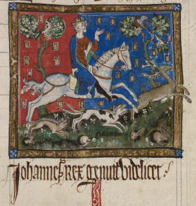
 King John hunting a stag with hounds.

King John hunting a stag with hounds.

De Lacy accompanied King Henry II as part of an Anglo-Norman invasion of Ireland in October 1171.

In early 1172 De Lacy was sent accept the surrender of Rory, the last High King of Ireland prior to the Anglo-Norman invasion. Before King Henry returned to England around the end of March 1172, De Lacy was granted authority over Meath and was given command of Dublin Castle.

The catch for De Lacy was he had to gain control of the portions of Ireland that Henry had granted to him. In an effort to control eastern Ireland, De Lacy began building a series of castles, including Trim Castle in Meath, Kilkea Castle, and a mott-and-baily structure in Clandard in County Meath.

Returning to England in late 1172, De Lacy was involved in a dispute with Archbishop of Canterbury Richard of Dover and in 1173 he led in an unsuccessful battle in France during fighting with French King Louis VII.[1]

De Lacy returned to Ireland as procurator-general in 1177 and quickly became a controversial figure.

As governor of Ireland De Lacy took control of both Leinster and Meath and continued building numerous castles.

De Lacy’s marriage to an Irish princess angered Henry.

De Lacy married the daughter of Ruadri O Conchobair, deposed High King of Ireland, in 1181 without asking Henry’s permission. He was recalled from his royal post because of the marriage. But he was sent back Ireland in 1182, this time with royal clerk Robert of Shrewsbury watching over him.

Henry sent his son John, the future King John, to Ireland in 1185. The prince complained to his father that De Lacy was preventing the Irish from paying tribute.

King John supposedly stayed in the castle for three days in 1210 while his army crushed a rebellion by Ireland’s Anglo-Norman lords. It then became known as King John’s castle.

Some accounts accuse De Lacy of trying rule Ireland on his own.

One account says De Lacy lost favor because of complaints of his injustice by the Irish. His mistreatment of the Irish leadership may have led to his death in 1186.

De Lacy’s murder is described in the Annals of Ulster –

“A.D. 1186. Hugo de Lacy went to Durrow to make a castle there, having a countless number of English with him; for he was king of Meath, Breifny, and Oriel, and it was to him the tribute of Connaught was paid, and he it was that won all Ireland for the English. Meath from the Shannon to the sea was full of his castles and English followers. After the completion of this work by him, i.e., the erection of the castle of Durrow, he came out to look at the castle, having three Englishmen along with him. There came then one youth of the men of Meath up to him, having his battle-axe concealed, namely Gilla-gan-inathar O’Megey, the foster son of the Fox himself (chief of Teffia), and he gave him one blow, so that he cut off his head, and he fell, both head and body, into the ditch of the castle.”

O’Megey, escaped. His motive may have been revenge for seizures of land by De Lacy, according to Alfred Webb’s A Compendium of Irish Biography, published in 1878.

In 1326 control of the castle was given to Geoffrey le Blound, then to Edmond Loundres in 1388, and Stephen Gernon in 1400. Henry MacShane O’Neill attempted to capture the castle in 1596.

The castle was held by the Irish Catholic Confederation during the Irish Confederate Wars 1641 to 1653. Sir Henry Tichborne, (Parliamentarian) gained control of the castle in 1642, then by Murrough O’Brien in 1649 and Charles Coote in 1650.

Jacobites fired on the castle in 1689 during the Williamite War. It was used as a Williamite hospital prior to the Battle of the Boyne.[2][3]

[1] Kingsford, Charles Lethbridge (1892). “Lacy, Hugh de (d.1186)”. In Lee, Sidney (ed.). Dictionary of National Biography. Vol. 31. London: Smith, Elder & Co.
[2] “Castles.nl – Carlingford Castle”, https://www.castles.nl/carlingford-castle.
[3] “Castle works progress – Independent.ie”, https://www.independent.ie/regionals/argus/news/castle-works-progress-31177882.html.
Four Masters, Annals of Ireland by the: Translated and Edited by John O’Donovan. 7 vols. Dublin, 1856.
Giraldus Cambrensis: Topography, and History of the Conquest in Ireland: Forester and Wright. London, 1863.
Music: Far Over The Highlands, Christopher Moe Ditievsen; The Norman Kings, Bonnie Grace

#ireland #irish #IrishHistory #irishcastle #history #carlingford #CountyLouth #englishhistory

Seán Hurley: Drinagh, Ireland’s Easter Rising Hero

Seán Hurley was the only Cork volunteer killed in Dublin during the Easter Rising of 1916.

Seán Hurley was born in July 1887 to John Daniel Hurley and Catherine Walsh of Drinagh, Co. Cork, Ireland. He was the youngest of seven children.

He attended Drinagh National School and the Clonakilty Boys School. Among his classmates in Clonakilty was Michael Collins.

Seán immigrated to London in 1906. He worked at Harrods department store as an accounts clerk.

He joined the Geraldine GAA club and was considered a good athlete. Among his team mates was Michael Collins.

Hurley joined the London branch of the Irish Republican Brotherhood. He also joined the newly formed London Branch of the Irish Volunteers.

Returning to the Dublin in January 1916, Hurley worked at Wilson and Crowe, Bootmakers, Lower Bridge Street, Dublin.

Hurley fought with the F Company, 1st Battalion. His commanding officers were Edward Daly, Piaras Beaslai, Jack Shouldice and Captain Fionán Lynch.

Hurley was garrisoned on Church Street during Easter Week.

Just before the rebels surrendered on 29 April 1916, Hurley was shot in the head and arm.

He was brought to the medical station at St. Mathews Hall, Church Street, which was run by the Capuchin Order. After the surrender he was transferred to Richmond Hospital where he was pronounced dead.

He was buried along with 15 other Easter Rising casualties in St Paul’s section, Republican Plot, Glasnevin cemetery, Dublin.

The commemorative sculpture in Drinagh portrays Seán Hurley in his volunteer uniform during the Rising. The sculpture was created by Don Cronin, http://www.doncronin.net/. Cronin also created the life size Bull in bronze in Macroom and Horse and Rider in bronze in Innishannon among many other works.

Partly funded by community donations and the Cork County Council, the statue was dedicated in 2016.

#ireland #irish #IrishHistory #EasterRising #1916 #Dublin #MichaelCollins #Drinagh #IrishRepublicanBrotherhood #Cork #CountyCork #WestCork #GaelicBar #DonCronin

Sources –

1916 Relatives Association
https://1916relatives.com/

1916 martyr Seán Hurley to be honoured in west Cork
https://www.irishtimes.com/news/ireland/irish-news/1916-martyr-Seán-hurley-to-be-honoured-in-west-cork-1.2630039

Drinagh’s Seán Hurley recalled in exhibition
https://www.southernstar.ie/news/drinaghs-Seán-hurley-recalled-in-exhibition-4155734

Michael Collins House 
https://www.facebook.com/michaelcollinshouse/posts/382047960597932/

Seán Hurley 1916 Commemorative statue
https://fundit.ie/project/sen-hurley-1916-commemorative-statue

Videos:
Seán Hurley 1916
https://youtu.be/8cFhZFanJ9w

Drinagh 1966 Seán Hurley Monument
https://youtu.be/3N22nwyZ_jE

Drinagh Seán Hurley Commemoration 1966 and 2016
https://youtu.be/hRV4hhoAdpY

Connolly’s Gaelic Bar
https://www.facebook.com/ConnollysGaelicBar/about
Don Cronin – Sculptor
http://www.doncronin.net/

3D Design shop

http://3ddesignshop.com/

The Mysterious Mint of Carlingford, Ireland

Carlingford’s Mysterious Mint

The Mint is located on Carlingford’s medieval main street.

It is a fortified town house or tower house dating to the 15th – 16th century, but its exact purpose is unclear.

The name “The Mint” is presumed to derive from a license granted to Carlingford by Edward VI of England in 1467 to mint coinage.[1]

The limestone building is believed to have housed one of Carlingford’s wealthy merchant families, the Marmions.[2]

However, some structural quirks of the building cast some doubt on whether it was a residence or a commercial building designed to house valuables. Thus the mystery of The Mint.

The building lacks a fireplace, suggesting it may not have been a residence. It is also highly fortified, with extra thick walls,

One historical fact that could indicate the structure was just an extra fortified residence is the fact that no coins minted in Carlingford have been found.

It’s defensive features include a a battlemented chemin de ronde on the roof, with loopholes for muskets. The street side doorway is protected by and elaborate machicolation, a structure for dropping stones or material such as boiling water, boiling oil, hot sand or quicklime[3] on attackers

The Mint also features a set of five highly decorated windows, three of which are at street level, on the side facing the street.

The ogee windows have carvings of a horse, a bust of a man, a bird, a snake and Celtic interlace designs. Some sources state this reflects a revival of interest in Celtic art during the 15th–16th centuries. Each of the windows have hood mouldings and mullions.

There are also five small windows on the rear each dressed either with an arch of stones or headers and sills. There is a large first floor opening on the rear of the building and what may have been a ground floor rear entrance that has been sealed up.

The Mint is the smallest of three fortified buildings in historic Carlingford.

Carlingford is also home to the majestic ruin, King John’s castle and the Taaffe’s Castle, another example of a fortified medieval Irish tower/town house.

[1]Ruding, Rogers (1 January 1840). Annals of the coinage of Great Britain and its dependencies: from the earliest period of authentic history to the reign of Victoria. Hearne. p. 241

[2]https://www.google.com/books/edition/Irish_knighthoods_and_related_subjects/-txZiDABfjcC?hl=en&gbpv=1&bsq=%22The+Mint%22+(Carlingford)&pg=PA78&printsec=frontcover

[3]Medieval castle SIEGES in depth

St Patrick Wasn’t Irish And He’s Not A Saint

St. Patrick isn’t Irish, and officially he’s not saint.

Patrick was never formally canonized. He lived before current Catholic Church laws on naming saints.[1]

Patrick was born in Britain to wealthy parents near the end of the 4th century as Roman rule was ending. His exact birthplace is uncertain.

The dates of Patrick’s life are also uncertain. It is generally accepted he died March 17. This date is Patrick’s feast day and is celebrated worldwide as St. Patrick’s Day.

There is general agreement among historians he was active as a missionary in Ireland in the fifth century.

Two works in Latin generally accepted as written by Patrick have survived. These are the autobiographical Declaration (Confessio) and the Letter to the soldiers of Coroticus (Epistola).[2]

These works provide the only generally accepted details of his life.[3]

According to the Confession of Saint Patrick, at the age of sixteen he was captured by a group of Irish pirates, from his family’s Villa at “Bannavem Taburniae”.[9]

Patrick escaped, returned to his family, and become a cleric. He returned to northern and western Ireland as a missionary, and later served as a bishop, but little is known about this time in his life.

By the 7th century, Patrick was revered as the patron saint of Ireland.

Two late 7th-century Patrick biographers documented the early exploits helping build his fame.[4][5]

In 431, Palladius was made the first bishop of Ireland, preceding Patrick.[7]

Palladius, from a prominent family in Gaul, was a deacon. Pope Celestine I made him a bishop and sent him to Ireland “to the Scotti believing in Christ”.[6]

Parts of both life stories may have been combined in Irish tradition.[10]

Palladius ministered in Ireland until the 460s.[8]

References and sources:

[1] Flechner, Roy (2019). Saint Patrick Retold: The Legend and History of Ireland’s Patron Saint. Princeton, NJ: Princeton University Press, page 1. ISBN 978-0691184647. https://www.google.com/books/edition/Saint_Patrick_Retold/YdVsDwAAQBAJ?hl=en&gbpv=1

[2]Both texts in original Latin, various translations and with images of all extant manuscript testimonies on the “Saint Patrick’s Confessio HyperStack website”. Royal Irish Academy Dictionary of Medieval Latin from Celtic Sources.

[3]Macthéni, Muirchú maccu; White, Newport John Davis (1920). St. Patrick, his writings and life. New York: The Macmillan Company. pp. 31–51, 54–60.

[4]These are the writings of Tírechán and the Vita sancti Patricii of Muirchú moccu Machtheni.[58]

[5]Byrne, pp. 78–79; Paor 1993, pp. 6–7, 88–89; Duffy 1997, pp. 16–17; Fletcher 1997, pp. 300–06; Yorke 2006, p. 112

“Christianity in Ireland before Patrick”. The Irish News. 21 January 2021. Retrieved 6 February 2023.

[7]Cusack, Margaret Anne, “Mission of St. Palladius”, An Illustrated History of Ireland, Chapter VIII, 1868 Public Domain This article incorporates text from this source, which is in the public domain.

Entry for AD 431 Chronicle of Prosper of Aquitaine

[8]Byrne, pp. 78–79; Paor 1993, pp. 6–7, 88–89; Duffy 1997, pp. 16–17; Fletcher 1997, pp. 300–06; Yorke 2006, p. 112

[9]“Confession of St Patrick”. Christian Classics Ethereal Library. 7 April 2013. Archived from the original on 22 February 2014.

[10]O’Rahilly, T. F. (1942). The Two Patricks: A Lecture on the History of Christianity in Fifth-Century Ireland. Dublin: Dublin Institute for Advanced Studies.

Music: A Celtic Blessing – Bonnie Grace

Read more on our website: https://irelandinsideandout.com/

If you enjoyed this video please support the channel Buy Me A Coffee: https://www.buymeacoffee.com/rdscallyN

St. Patrick and the Hill of Slane

In 433 AD St. Patrick lit a fire on Hill of Slane, in an act of defiance of the pagan High King Lóegaire (Laoire), according to the monk Muirchú’s highly mythological 7th century hagiography of St. Patrick, Vita sancti Patricii.

Lóegaire had forbidden any other fires while a festival fire was burning at his headquarters on the Hill Tara, which can be clearly seen from the Hill of Slane, about 16 kilometers (about 10 miles) away, according to Muirchú’s account.

Other accounts of the life of St. Patrick describe various versions of what happened after the saint lit his defiant fire. The accounts agree that Lóegaire apparently allowed St. Patrick, who he had reportedly been trying to assassinate, to continue spreading the word of Christianity in Ireland.

In another legendary act, St. Patrick would later in his life baptize two of Laoghaire’s daughters, Eithne the Fair and Fedelm the Red at Rathcroghan’s Ogulla Holy Well in County Roscommon.

Today the Hill of Slane is dominated by a group of picturesque ruins and historical sites, most dating to the middle ages.

The ruins of a friary church, with a still in use graveyard, and college can be seen on the top of the hill. The now ruined friary church was built on the site of an earlier church, was restored in 1512. The ruins include a 19-meter (62 ft) high early gothic tower.

The friary was abandoned in 1723.

A holy well, now filled in with rocks due to safety concerns, is located just inside the graveyard’s wall.

At this well, Patrick is said to have baptized St. Erc, a pagan priest, who he appointed a bishop. The foundation of the original monastery on the Hill of Slane is attributed to St. Erc and it remained active for at least six hundred years.

The baptism and life of St. Erc are on firmer historical footing than many of St. Patrick’s mythical exploits such as driving the snakes out of Ireland.

Next to the friary church is a structure known as the college.

These ruins are from different phases of construction and various purposes, according to the Voice From Dawn website.

From Voice of Dawn:
“The earliest building, likely a tower house, is now known as the “rectory,” and was used for the administration of the parish. In the late 15th century a chantry college was built on the site, endowed for priests to celebrate masses for the souls of the Fleming family. The structure housed four priests, four lay-brothers and four choirboys in some comfort, with fireplaces and a double garderobe (toilet). The buildings were situated around an open rectangular cloister.

The college was rebuilt in the 16th century with a further Fleming family bequest, There was once a bawn (defensive enclosure) around the tower house, whose only remnant today is its massive gatehouse.”
https://voicesfromthedawn.com/hill-of-slane/

Over the centuries the site endured numerous attacks and tribulations including dissolution of the monastery by Henry VIII in 1631 and attacks by Oliver Cromwell’s troops in 1651.

Sources and links:
Discovery Boyne Valley
https://www.discoverboynevalley.ie/boyne-valley-drive/heritage-sites/hill-slane

Voices From Dawn
https://voicesfromthedawn.com/hill-of-slane/

Slane and District History Society
https://slanehistoryandarchaeologysociety823029674.wordpress.com/

Meath County Council – Hill of Slane
https://www.meath.ie/discover/heritage/heritage-sites/hill-of-slane

Read more on our website: https://irelandinsideandout.com/
Please support the channel: Buy Me A Coffee: https://www.buymeacoffee.com/rdscallyN

Music:
Highland Hymn - Bonnie Grace
Celtic Blessing - Bonnie Grace
Tudor - Bonnie Grace

#ireland #irishhistory #irish #history #HillOfSlane #stpatrick #earlychristian #saintpatrick #saintpatricksday #meath

The Tower of Power – Roodstown Castle: Inside A Fortified Tower House In The Dublin Pale – County Louth, Ireland

Chapters: 00:00 intro 00:50 The Pale 01:21 Tower House subsidy and building boom 01:33 Ardee Castle – Ireland’s largest Tower House 02:50 A look inside from the northwest side. 03:40 Another look inside O4:08 View of the vaulted ceiling storeroom 04:31 Stone Spiral Staircase 04:59 The murder hole 05:15 Castle features 05:58 Site of forge and blacksmith shop

Roodstown Castle is a 15th-century fortified tower house and National Monument located in County Louth, Ireland.

Tower houses were fortified residencies of Irish rural gentry built during the 15th and 17th centuries. Roodstown Castle is associated with the Taaffe family, who were active in the area until the 17th century.

In the mid-fifteenth century men loyal to the English crown living in the Dublin (English) Pale were offered a £10 annual government subsidy to construct a fortified house within the Pale. £10 may not sound like a lot, but in the mid-15th century this was enough money to buy 13 horses or 25 cows or pay a skilled craftsman for almost a year. https://www.nationalarchives.gov.uk/c…

Thanks to the subsidy, numerous tower houses were built win the Pale during the 15th century. Pioneering Irish historian and archeologist Harold G. Leask estimated that more 2500 tower house may have been built in Ireland. There are similar structures in Scotland.

There are 26 tower houses in Co. Louth. Roodstown may have been one of these subsidized tower houses. Roodstown Castle shows the original owners’ wealth and the builders’ craftsmanship six hundred years ago.

The castle’s detailed window and door openings are testament to the skills and craftmanship of the area’s stone workers.

Subsidized or not Roodstown Castle sits at a strategic location between the River Glyde, River Dee, Ardee and the Irish Sea. Roodstown Castle is considered an excellent example of a surviving tower house since its original outside structure is still intact.

Constructed of rubble masonry with limestone trim, Roodstown Castle is a rectangular four-story tower house with small turrets at diagonally opposed corners.

There is a spiral stairway in the southeast side and garderobes in the northwest. The castle contained a vaulted ground-floor cellar or storage space, a murder-hole, a crenelated parapet, chemin de ronde.

The upper floors have large ogee arch windows and fireplaces. The roof and timber floors above the ground floor no longer exist. Roodstown Castle was occupied during a tumultuous period of history. The nearby town of Ardee, which has its own significant tower house, Ardee Castle, suffered mightily during this time.

Roodstown Castle is located 3.6 km (2.2 mi) north-northeast of Ardee. There is no access to the inside of the castle for safety reasons and the main gate to field where the castle is located is frequently locked. https://www.geograph.ie/photo/881262

Help support the channel: Buy Me A Coffee https://www.buymeacoffee.com/rdscallyN

Sources:

Dolan and Murray, n.d., p.75 in Mitchell, Frank & Tuite Breeda, ‘The Great Bog of Ardee’, Journal of the County Louth Archaeological and Historical Society, 1993, Vol.23 No.1, pp.7-95.

Donnolly, Colm J., ‘Frowning Ruins: The Tower Houses of Medieval Ireland,’ History Ireland, Vol. 4 No.1, Spring 1996, 11-16.

Leask, Harold G., Irish Castles and Castellated Houses, Revised 2nd ed., Dundalgan Press, Dundalk, 1951, p.75.

Mitchell, Frank & Tuite, Breeda, ‘The Great Bog of Ardee’, Journal of the County Louth Archaeological and Historical Society, 1993, Vol.23 No.1, pp.7-95.

Rowan, Alistair, ‘The Irishness of Irish Architecture’, Architectural History, 1997, Vol.40 pp.1-23. Wright, Thomas, Louthiana: Or an Introduction to the Antiquities of Ireland, 1758, Dundalk: W. Tempest Limited.

Links to further reading:

http://www.askaboutireland.ie/reading…

http://catalogue.nli.ie/Record/vtls00…

http://catalogue.nli.ie/Record/vtls00…

http://catalogue.nli.ie/Record/vtls00…

http://downsurvey.tcd.ie/down-survey-…

https://www.duchas.ie/en/cbes/5008856…

https://geohive.maps.arcgis.com/apps/…

http://irishantiquities.bravehost.com…

https://www.libraryireland.com/topog/…

https://www.logainm.ie/ga/1165428?s=r…

https://www.logainm.ie/ga/33627

https://theirishaesthete.com/tag/rood…

#ireland #irish #irishhistory #countylouth #medievalireland #medievalcastle #thepale #englishhistory #towerhouse #irishcastle #ardee #roodstown