Inside St. Brigid’s Holy Well – Imbolc/St. Brigid’s Day

St. Brigid is the bridge between paganism and Christianity in Ireland.

St. Bridgid is one of the three Irish national saints – the others are Patrick and Columba. She is considered the patroness saint, or mother saint, of Ireland. https://www.libraryireland.com/Wonders/St-Brigit-1.php/

Feb. 2023 marks the first year that St. Brigid’s Day will be a national holiday in Ireland, the first named for a woman. https://www.newsendip.com/saint-brigid-day-ireland-first-public-holiday-created-after-a-woman/

The result of a successful three-year campaign to establish St. Brigid’s Day, Ireland’s newest national holiday will be observed in 2023 on Monday, 6 February.

The initiative to make St. Brigid’s Day an Irish national holiday was spearheaded by HerStory https://www.herstory.ie/home, an organization founded in 2016 that tells women’s stories through education and arts programs.

Also known as Saint Brigid of Kildare or Brigid of Ireland, she is purported to have been born and raised circa  451 AD in Faughart just north of Dundalk in County Louth. She is said to have died in Kildare on 525 AD.

St. Brigid is the patron saint of Ireland, poetry, learning, healing, protection, blacksmithing, livestock and dairy production. A very busy saint, Brigid is also patron saint of babies, boatmen, children whose parents are not married, children whose mothers are mistreated by the children’s fathers, Clan Douglas, fugitives, Leinster, mariners, midwives, nuns, the poor, poultry farmers, printing presses, sailors, scholars, travelers, and watermen.

However, there are few historic facts about Brigid. There is on-going debate among both secular and Christian scholars over whether she was a real person.

St. Brigid shares her name with a Celtic goddess.

Some scholars suggest that St. Brigid is a Christian version of the pagan goddess. Others argue that she was a real person whose story was given the goddess’s attributes.

Christian monks “took the ancient figure of the mother goddess and grafted her name and functions onto her Christian counterpart,” art historian Pamela Berge asserts.

St. Brigid was an abbess who founded several convents, most notably in Kildare, which were Ireland’s most important, according to medieval Irish hagiographies.

“By the end of the seventh century, at least two Latin biographies had been written describing her as a nobleman’s daughter who chose to consecrate her virginity to God, took the veil as a Christian nun, and became the leader of a community of religious women — or perhaps of both women and men,” Phylilis G. Jestice wrote in ‘Holy People of the World: A Cross-Cultural Encyclopedia’. “Certainly, by the seventh century, there was an important double monastery at Kildare that regarded her as its founder.”

Votive Offerings and The Rag Tree

Pilgrims often leave votive offerings at St. Bridgid’s Holy Well. Growing next to the well is a rag tree. A common offering at holy wells is a rag or piece of cloth that is attached to the ‘rag tree’, which is often also considered holy. Offerings include pins, medals, rosary beads, holy pictures, statues and so forth. The offering represents the sickness the pilgrim wants cured.

St. Brigid’s feast day is 1 February, which was originally a pre-Christian festival called Imbolc, marking midwinter day, the beginning of spring. Brigid was a fire goddess in ancient Irish mythology. Today St. Brigid is celebrated with a perpetual flame at her shrine in Kildare.

St. Brigid’s Day/Imbolc traditions and customs https://www.irishcentral.com/roots/st-brigids-day-traditions

A folk tradition celebrated on St. Brigid’s Day or Imbolc is Brigid’s Bed. Girls and young unmarried women make a corn doll representing Brigid that is called the Brideog and they make a bed for the Brideog.

the girls and young women gather in one house and stay up all night with the Brideog. The next day they visited by the young men of the community who must ask permission to enter, and must then treat them and the doll with respect.

Brigid is said to walk the earth on Imbolc eve. On St. Brigid Day’s eve people may leave clothing or strips of cloth outside for Brigid to bless when she passes by in the night.

A Brigid of Faughart Festival http://www.brigidoffaughart.ie/ takes places in 2023 from 29 January to 6 February at the An Táin Arts Centre Crowe Street, Dundalk, Co. Louth, St. Brigid’s Shrine and several other locations in co. Louth.

Click here for more information: http://www.brigidoffaughart.ie/festivals/

Buy Me A Coffee: https://www.buymeacoffee.com/rdscallyN

ireland #irishhistory #imbolc #irish #louth #Faughart #countylouth #holywell #saintbrigid #hilloffaughart #medieval #edwardbruce #ragtree

The Secrets of The Hill of Faughart: A Saint, a King and 3 Epic Battles!

Here a saint was born. A king was killed. A vanquished chieftain lost his head. Three major battles were fought.

There’s a centuries-old cemetery, a ruined medieval church and a holy well that attracts pilgrims from around the world. There’s even the remains of an iron age Norman-style motte-castle.

Here is the Hill of Faughart.

Located just north of Dundalk, County Louth, Ireland, the Hill of Faughart has a lot of Irish myth and history going on in one fairly small site.

The hill itself is in a natural position to become an important place. Occupied since prehistoric times, Faughart was strategically important for centuries.

Faughart overlooks the Gap of the North/Moyry Pass — eastern Ireland’s main south-north route — Dundalk and its bay, the Cooley mountains and Slieve Gullion to its north. It has a clear view north and east of a large area.

The remains of an iron age, Norman-style earth-and-wood motte-castle stand to northeast of the cemetery, evidence of Faughart’s strategic location.

Even by Irish stands Faughart is steeped in history. It is the birthplace of St. Brigid, 451 AD. It is the burial place High King of Ireland Edward Bruce who was killed near here 14 October 1318.

St. Brigid is Ireland’s female patron saint. Sharing a name with a popular Celtic pagan goddess, Brigid is the bridge between paganism and Irish Christianity. Few historical facts are known about St. Brigid’s life, but she is an extremely popular saint both in Ireland and around the world.

There are three sites related to St. Brigid at the Hill of Faughart. The most significant site is St. Brigid’s Holy Well.

The holy well attracts pilgrims who believe the well’s water has healing powers. The second is St. Brigid’s Bed, said to be the remains of a hut where she slept. The third site is St. Brigid’s Pillar.

This site appears to be the remains of the base of a round tower that once existed there. In the center of the circle is a piece of a broken Celtic high cross. A church has existed on the Faughart since at least the 4th century and monastery once existed there. The ruined church in the graveyard dates from the 12th century.

A rag tree grows above the holy well. Pilgrims leave various votive offerings, often strips of cloths or rags, in hopes of healing ailments or being granted answers to prayers.

Faughart was at the center of three significant battles. In 248 AD, a battle was fought by Cormac Ulfada, High King of Ireland, against Storno (Starno), king of Lochlin (Scandinavia). Ulfada prevailed.

Legend has it that the defeated Storno was allowed to sail home to Scandinavia. https://books.google.com/books?id=NSE…

In 732 AD, Áed Allán, king of Ireland, fought a battle with Áed Róin, king of Ulaid, over what amounted to an insult to a parish controlled by a powerful bishop[. 2]https://books.google.com/books?id=NSE…

Áed Róin was vanquished and wound up having his head cut off on The Stone of Decapitation (Cloch-an-chommaigh) in the doorway of the church of Faughart. A number of other chieftains in Áed Róin’s army were also killed.

Today there are several stones near the entrance of church. It was unclear when we visited which stone was THE Stone of Decapitation. If you know the answer please let us know in the comments.

Perhaps the most significant Battle of Faughart was fought 14 October 1318 between Hiberno-Norman forces led by John de Bermingham, 1st Earl of Louth, and Edmund Butler, Earl of Carrick and his Scots-Irish army commanded by Edward Bruce.

Bruce was the brother of Robert Bruce, King of Scots, Edward Bruce has been backed as King of Ireland by some Irish chieftains. Butler’s army was defeated. Bruce was killed. His body was quartered and sent to various towns in Ireland. His head was sent to King Edward II in England.

Thus, it is hard to know what, if any parts of Bruce, are actually buried in the grave at Faughart. The Battle of Faughart was part of the First War of Scottish Independence, during a three-year era known as the Irish Bruce Wars. Bruce’s death ended an attempt to revive the High Kingship of Ireland.

Buy Me A Coffee: https://www.buymeacoffee.com/rdscallyN
We’re on Mastodon: https://mastodon.ie

Exploring Carrowmore Megalithic Cemetery, Co. Sligo, Ireland, ft 3-D Stone Circle Scans

Ireland’s distant past speaks to the present at Carrowmore Megalithic Cemetery.

Located on the Cúil Irra Peninsula on Co. Slio, Ireland, Carrowmore is the oldest and largest group of megalithic tombs in Ireland. It is also one of Europe’s largest megalithic cemeteries.

Thanks to extensive archeology, historic documentation, advanced scientific analysis and recent preservation efforts, Carrowmore provides a window into who the Irish of 3500 BCE were and what they were up to.

Carrowmore is set within a spectacular megalithic landscape dominated by the mountain of Knocknarea to the west. On Knocknarea’s summit is one of Ireland’s largest cairns, known as Queen Maeve’s Cairn.

There are bout 50 megalithic tombs on the Cúil Irra peninsula. Most of these, 30 tombs, are at Carrowmore.

Carrowmore’s tombs were built from 3500 BCE to 2900 BCE, during the Neolithic, New Stone Age, according to radio carbon dating results. It’s likely people who built the tombs were Ireland’s first farmers.

Carrowmore is one of Ireland’s ‘big four’ megalithic clusters along with nearby Carrowkeel in Co. Sligo and Loughcrew and Brú na Bóinne in Co. Meath.

Archaeologists consider Carrowmore – like Newgrange, Loughcrew and Carrowkeel – part of the Irish Passage Tomb Tradition.

There may have once been as many as 100 megalithic  monuments in the Carrowmore area. Many of the tombs were destroyed or damaged during the during the 18th, 19th and early 20th centuries by quarrying, field clearance and by antiquarians hunting for ancient treasures.

A number of monuments are located on private property adjacent to the public National Monument.

Today Carrowmore is a protected Irish National Monument and is maintained by the Office of Public Works.

Extensive Research

Although many of the monuments have been disturbed, Carrowmore has been the subject of extensive research.

Dutch artist Gabriel Beranger visited Carrowmore in 1779 and drew some of the monuments. A valuable record of Carrowmore at the time, his drawings monuments since destroyed or damaged.

Pioneering photographers, such as W.A. Green and R.J. Welch of the Belfast Photographer’s club, photographed Carrowmore at  the turn of the twentieth century.

Local landlord Rodger Walker conducted unrecorded antiquarian excavations in the 19th century. These digs were essentially treasure hunts to augment Walker’s antiquities collection. Walker kept poor records of his activities. Some of the Walker’s finds are now at Alnwick castle in Northumberland, England.

The Carrowmore monuments were mapped and numbered by Irish archeologist George Petrie in 1837 during the first mapping of Ireland conducted by the British Ordinance Survey. Petrie’s number system identifies the monuments today.

George Petrie
George Petrie

In the 1880s Sligo-born archaeologist and army officer Col. W.G. Wood- Martin conducted the first recorded excavations and made numerous finds.

Extensive excavations led by Swedish archaeologist Göran Burenhult were conducted from 1977–1982 and 1994–1998 and 10 tombs were fully or partially excavated. Listoghil, Tomb 51, was excavated in 1996-1998.

At least two sets of archeologists have conducted extensive research on Carrowmore’s age using radio carbon dating and studies of nearby lake sediments. Carrowmore’s monuments were found to span the era from 3750 BCE to 3000 BCE and the builders were farmers.

Multimillenia-old human remains found at Carrowmore have been able to tell their story thanks to DNA analysis.

Intimate connections between occupants of other Irish passage tombs have been revealed by DNA derived from human bones found at Carrowmore. A detectable kin relationship was found between a male buried in Listoghil, Carrowmore’s Tomb 51, and three other males buried in Newgrange, Millin Bay and Carrowkeel.

This DNA relationship points to the existence of a sophisticated interrelated hereditary elite that could inspire the creation of increasingly large and complex tombs and ritual sites across a wide portion of Ireland. In a time before Stonehenge or the Egyptian pyramids, an Irish farming-based society without cities managed to use stone, bone and wooden tools to build religious monuments that have defied destruction and still retain their place in the landscape.

Modern scientific analysis of ancient genetics proves the ancestor of the people who built Ireland’s megalithic monuments originated in Anatolia, in what is now Turkey.[12]

Carrowlmore is the megalithic site keeps on giving for archeologists doing the digging.

In 2019 a team of researchers led by Marion Dowd and James Bonsall of the Institute of Technology Sligo uncovered feature unlike any other seen in Ireland.

The Sligo team conducted geophysical surveys at the Carrowmore megalithic complex, finding a circular structure that was away from where tombs have beeb found. The feature was thought to be a barrow, a circular earthen monument surrounded by a ditch.

Once the team put trowels to the soil something unexpected emerged.

IT Sligo Excavation at Carrowmore Megalithic Cemetery, May-June 2019

“Our survey revealed several features that were not visible above ground,” Bonsall said in an article in the publication Archeology. “We discovered that the ‘barrow’ contained a central pit and a substantial circular ditch.”

A sunken area within the layer of stone contained black, charcoal-rich soil, Dowd said in Arecheology.

“So far, we cannot find any parallel for it in Ireland,” Dowd said.

Listoghil or Tomb 51 – Carrowmore’s Focal Point

Listoghil or Tomb 51

Listoghil was built circa. 3500 BCE and is 34 metres in diameter. It the only cain at Carrowmore.

It has a distinctive box-like inner chamber.

The front edge of the entrance covering stone has marks that may be the only megalithic art at Carrowmore.

Three large boulders were found beside the central chamber. Under the cairn may be the remains of a destroyed passage or of a megalithic construction that predates the cairn.

Many of the satellite tombs face the central area. Tomb 51’s location appears to have been the cemetery’s focal point.

Unburned bones as well as cremations has been found in Listophil.

The alignment of Listoghil points at a low saddle-like formation 6.5 km to the east-southeast in the Ballygawley Mountains. The alignment  coincides with sunrise at the start and the end of winter, important seasonal festivals in the Gaelic calendar.

Satellite tombs

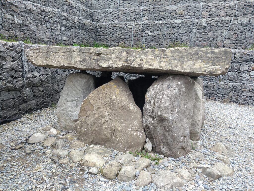
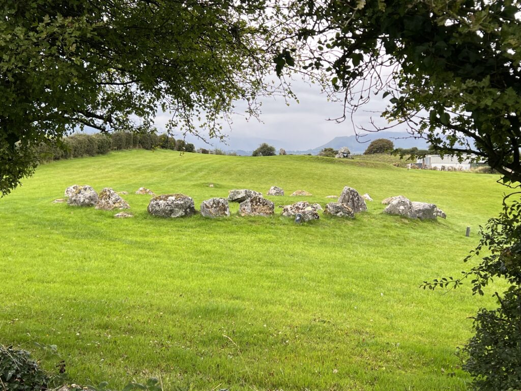
Corrowmore’s monuments originally consisted of a central dolmen-like megalith with five upright orthostat stones with roughly conical capstones on top enclosing a small pentagonal burial chamber. These tombs were each enclosed by a boulder circle 12 to 15 metres in diameter.

The boulder circles contain 30 to 40 boulders. The stone monuments are usually made with gneiss, the stone material of choice for the tombs. Some tombs have a second, inner boulder circle.

Tomb 3

Entrance stones (or passage stones, crude double rows of standing stones) extend from the central feature, showing the intended orientation of the dolmens. The monuments generally face towards the area of Tomb 51, the central cairn. Four monuments are in pairs.

Each monument was built on a small level platform of earth and stone. Stone packing surrounding the base of the upright stones that locks them in place is one of the secrets of the dolmens’ longevity.

Irish folklore dates Carrowmore’s tombs to Ireland’s mythology and the Battle of Magh Tuireadh, where the Firbolgs were defeated by the Tuatha De Danann.

Carrowmore’s ritual landscape may have taken on new meaning long after the original builders of the monuments were long gone. Archeological evidence suggests tombs that during the later Bronze and Iron Ages some tombs rebuilt and reused.

What to know if you visit Carrowmore:

Admission is 5 euro.

Open May to September 10:00 to 5:00

There’s parking lot on the south side of the road adjacent to the visitor’s center. Parking is free.

It’s worth spending a few minutes in the small museum in the visitor’s center, especially if you are visiting the site with young people.

Allow at least an hour to explore. The views of the surrounding area alone are work the walk around the site.

A two-sided, laminated map and guide to the site is available at the front desk of the visitor’s center for a REFUNDABLE 2 euro. Get the map. You’ll be glad you did.

Although the site is mowed and generally open it is not wheel chair friendly. People with mobility issues who walk with a cane or trekking poles may be able to access some of the site, particularly the North Walk, which is smaller and more level than the south side. Caution is advised at all times.

DO NOT climb on any of the monuments.

The are bathrooms with changing tables.

In the summer months there is a good coffee cart next to the visitor’s center.

Ireland Inside and Out website home page

Buy Me a Coffee

OPW Carrowmore website

Irish Tourism Carrowmore Megalithic Cemetery website

High Crosses of Kilfenora Cathedral

High Crosses of Kilfenora Cathedral

High Crosses of Kilfenora Cathedral #ireland #irishhistory #celticcross #kilfenora #countyclare #doortycross

Saint Fachtnan’s Cathedral, KILFENORA, Kilfenora, CLARE https://www.buildingsofireland.ie/bui… For more detailed information and links to sources please visit http://irelandinsidenadout.com.

Kilfenora was the site of an important early monastic settlement. St. Fachtna founded an Abbey here in the sixth century. Kilfenora gained the title “City of the Crosses”, a reference to the High Crosses within or near the precincts of the cathedral. The Doorty Cross https://www.clarelibrary.ie/eolas/coc…

This 12th century cross is the centerpiece of the glass-roofed chapel at Kilenora. High cross expert Brian Mooney has been cited as saying that it is a 12th century cross of post-Norse because of its design, which includes a carving of Saint Fachtnan, Kilfenora’s original bishop. The cross was broken apart into two pieces, with the lower slab described by archeologists in 1910 along with head of a cross in the sacristy.

In 1946 researchers realized that the cross head and the monumental stone belonged to the same monument. in the mid 1950s the two parts were joined together and placed standing near the Doorty family grave where the slab had lain since 1752. It became known as the “Doorty Cross.”

In 2003 the heavily weather cross was moved under the glass roof of the cathedral to protect it. North Cross Near the north western corner of the cathedral graveyard is the North Cross. According to an article by Jack Flanagan, until approximately 1955 the cross was buried deeply at the head of a grave of the Quinn family in the parish. About that time the cross was raised and now it stands about two meters tall.

The cross appears early in design and has no ring, so in all respects it looks like it was designed as a marker for the lands around the Abbey. https://www.clarelibrary.ie/eolas/coc… The South Cross https://www.clarelibrary.ie/eolas/coc…

The south cross stands within the graveyard near the south wall. Only a portion of its shaft survives. It stands near the entrance door to the Cathedral’s nave, near where it was found. The upper part is missing. The cross was originally about four meters tall based on the size of the shaft.

The High Cross aka the West Cross https://www.clarelibrary.ie/eolas/coc…

The cross in the field west of the cathedral is the tallest and best preserved of the Kilfenora group. It has been heavily weathered, especially on its west face. It is 4.5 meters tall and tapers by about 25 centimeters from base to top.

Elaborately carved, the cross may have once been part of a tomb or shrine, a theory that stems from an unworked portion of stone at the base. Read more at https://irelandinsideandout.com/ Contact: [email protected]

Bunratty Castle and Folk Park: Top Irish Tourist Destination

Brunratty Castle and Folk Park

#irish #castle #irishhistory #bunratty #countyclare #ireland

Bunratty Castle is a large 15th-century tower house in County Clare, Ireland. https://www.bunrattycastle.ie/

The castle and adjoining folk park are one of Ireland’s top tourist attractions. The current structure is the forth castle to occupy the site.

This one was built by the MacNamara family after around 1425. At around 1500, Bunratty Castle came into the hands of the O’Briens (or O’Brians), dominate clan in Munster and later Earls of Thomond. They expanded the site and eventually made it their seat.

In 1720 the O’Breins sold the site. By the late 1800s the castle had fallen into disrepair. In 1956, the castle was purchased and restored by Standish Vereker, 7th Viscount Gort, with assistance from Ireland’s Office of Public Works.

Bunratty Castle opened to the public in 1960, with sporting furniture, tapestries and works of art dating to around the 1600’s.

A folk park, preserving traditional Irish homes, from the humblest to the most prosperous, has been developed on the 240 acres around the castle.

Today the property is run by Shannon Heritage a company that also operates tourist attractions Craggaunowen – The Living Past Experience, Co Clare, Knappogue – Co Clare, Dunguaire Castle, Co Galway. https://www.shannonheritage.com/about…

Buy Me A Coffee https://www.buymeacoffee.com/rdscallyN
Marconi Was Irish

Guglielmo Marconi was IRISH.

Irish!? Wait.

Guglielmo Marconi. One of the most famous Italians of modern times. How could he be Irish?

OK. Guglielmo Marconi was HALF Irish.

Marconi’s mother was Anne Jameson. Annie Jameson of Daphne Castle in County Wexford, Ireland. She was a granddaughter of John Jameson, founder of whiskey distillers Jameson & Sons.

Marconi was born into the Italian nobility.

Annie Jameson was an aspiring opera singer. She travelled to Italy to study.
She met and married widower Giuseppe Marconi, an Italian aristocrat, while in Italy.

Guglielmo Giovanni Maria Marcon was born 25 April 1874 in Bologna, Italy. Living at Villa Griffone, near Bologna,.

Guglielmo Marconi was educated at home by a series of tutors. He spent time Ireland as youth and as child lived in England for about four years with his mother.
https://www.vaticannews.va/en/world/n…

While teenager, Marconi began working on ‘wireless telegraphy’.

Summer of 1895, Guglielmo, 21, made his first wireless over land transmission of 3 kilometers at Villa Griffone.

And radio was born.

Italy uninterested in Marconi’s work.

But England was.

In 1896 he traveled to London.

Sir William Preece, the chief electrical engineer of the British Post Office, supported Marconi’s work.Soon it was being tested by engineers

In 1987, Marconi made his first wireless transmission over the sea.

A test between Ballycastle and Rathlin Island off the County Antrim coast for insurance company Lloyds of London took place In 1898. This was the first commercial wireless telegraph transmission.

At the turn of the 20th century, Marconi began investigating sending transatlantic wireless messages to compete with the undersea telegraph cables.

Marconi set up wireless transmitting stations in Ireland and Canada to compete with transatlantic telegraph cables.

Marconi established a wireless transmitting station at Marconi House, Rosslare Strand, County Wexford, in 1901 to act as a link between Poldhu in Cornwall, England, and Clifden in Connemara, County Galway, Ireland.

Regular transatlantic radio-telegraph service begun on 17 October 1907 between Clifden, Co. Galway, Ireland, and Glace Bay.

Marconi won the Nobel Prize for physics in 1909.

The first trans-Atlantic wireless telephone conversation between Ballybunion, Co. Kerry and Louisburg, Nova Scotia took place in 1919.

On 17 December 1902, a transmission from Marconi’s station in Glace Bay, Nova Scotia, Canada, became the first radio message to cross the Atlantic from North America to Europe.

Marconi and his wireless are credited with the rescue of the 706 survivors of the Titanic’s sinking. The Titanic’s radio operators – Harold Bride and Jack Philips – were Marconi Company employees. Radio contact with the Cunard liner the Carpathia led to the rescue of the Titanic survivors.

Bride survived the Titanic disaster but was badly injured. Philips, the wireless operator on duty the night of the sinking, did not.

Marconi had been offered free passage on Titanic’s maiden voyage. But he had taken the Lusitania, which would be sunk by German U-boats in 1915, to New York.

Marconi also had another personal connection to Ireland.

While in England, he met Beatrice O’Brien (1882–1976), a daughter of Edward Donough O’Brien, the 14th Baron Inchiquin.

Beatrice O’Brien and Marconi were married 16 March 1905. They had three daughters and a son.

The Marconi family returned to Italy In 1913, joining Rome’s high society. Beatrice became a lady-in-waiting to Queen Elena.

Marconi and Beatrice divorced in 1924. Marconi had the marriage annulled in 1927 so he could remarry in the Catholic Church.

Marconi joined the joined the Italian Fascist party in 1923, just as the party rose to power.

Fascist dictator Benito Mussolini, who used radio to spread the Fascist message, was Marconi’s best man when he married Maria Cristina Bezzi-Scali in 1927.

In 1930, Mussolini made Marconi president of the Royal Academy of Italy, and a member of the Fascist Grand Council. Marconi was an advocate of fascist ideology.

He personally ensured that Jews were not appointed to the scientific society during his time as president. https://www.theguardian.com/world/200…

In 1937, while developing microwave technology, Marconi had a series of nine heart attacks.

He died in Rome on 20 July 1937, age 63.

Marconi’s remains are interred in an elaborate mausoleum adjacent to the 17th-century Villa Griffone/Villa Marconi, located in Pontecchio Marconi, outside Bologna in Emilia Romagna, Italy.

He didn’t not look like it or act like it. But Marconi was half Irish.

Spanish Armada Wreck On Streedagh Beach, Co. Sligo, Ireland

Spanish Armada Wreck At Streedagh Beach

On 21 September 1588, three damaged vessels of the Spanish Armada were blown ashore during a violent storm on Streedagh Beach in what is now County Sligo, Ireland.

The three ships were carracks, armed merchant ships.

The three ships were the La Lavia (25 guns), a Venetian merchantman and the vice-flagship; La Juliana (32 guns) a Catalan merchantman; and Santa Maria de Vison (de Biscione) (18 guns) a Ragusan merchantmen.

The ships were 3 of 28 from the Spanish Armada, part of an unsuccessful attempt to invade England, that had fled to the Irish coastline after the invasion plan collapsed in August 1588. The three ships retreated to the west coast of Ireland and were anchored about a mile offshore when a major storm began.

On 21 September, the ships’ anchor cables gave way in heavy seas. When the storm began on 17 September all three ships were already in serious trouble.All three were heavily damaged from battle in the English channel.

All three had cut their main anchors to flee the English fleet when the battle of Battle of Gravelines began.

Having no main anchors made anchoring near to shore difficult. When the ships hit the shore, they broke apart in less than hour.

Accounts differ by about 1,800 men drowned, according to an account by Captain Francisco de Cuellar, one of the few survivors.

Approximately 300 made it ashore.“ ..and not being able to weather round or double Cape Clear, in Ireland, on account of the severe storm which arose upon the bow, he was forced to make for the land with these three ships, which, as I say, were of the largest size, and to anchor more than half a league from the shore, where we remained for four days without being able to make any provision, nor could it even be made.

On the fifth day there sprang up so great a storm on our beam, with a sea up to the heavens, so that the cables could not hold nor the sails serve us, and we were driven ashore with all three ships upon a beach, covered with very fine sand, shut in on one side and the other by great rocks. The likes of this had never been seen for, within the hour, our three ships broke up completely, with less than three hundred men surviving.

Over a thousand drowned among them many important people, captains, gentlemen and regular officers….many men drowned inside the ships, while others jumped into the water never to come up again.” — Captain Francisco de Cuellar
https://babel.hathitrust.org/cgi/pt?i…

Once ashore, most of the survivors were attacked by locals and robbed of everything, including their clothes, or they were attacked by English soldiers and slaughtered. De Cuellar managed to survive a number of encounters with robbers and the English.The late sixteenth century. and 1588 in particular, was marked by unusually strong North Atlantic storms.

Most of the 28 Spanish ships lost in the storms were along the jagged steep rocks of the western coast of Ireland.

About 5,000 men died by drowning, starvation and slaughter by local inhabitants after their ships were driven ashore on the west coasts of Scotland and Ireland.

English soldiers in Ireland were ordered to kill any Spanish prisoners, England’s Lord Deputy William FitzWilliam instead of asking for ransom as was common during that period.

The locations of the wrecks were discovered in 1985.

https://www.youtube.com/watch?v=nqCs-… and some other artifacts were recovered in 2015. https://www.youtube.com/watch?v=kOyas… The local community commemorates the event each year on the third weekend in September. https://www.youtube.com/watch?v=Mj5jx… Armada In Irelandhttps://spanisharmadaireland.com/

Who Is Buried in Yeats’ Grave?

William Butler Yeats, renowned Irish poet, playwright and writer, winner of the 1923 Nobel Prize for literature, is buried in St. Columba’s church graveyard in Drumcliff (sometimes spelled Drumcliffe) in County Sligo, Ireland.

Or is he?

Yeats died at the Hôtel Idéal Séjour, in Menton, France, on 28 January 1939. He was 73.[1] Yeats was buried at Roquebrune-Cap-Martin following a discreet and private funeral.

But Yeats’s family wanted him buried in Ireland, in the graveyard of the neo-Gothic style St. Columba’s, where his great grandfather had been rector.

Attempts were made in France to dissuade the family from relocating the remains to Ireland due to the uncertainty of their identity.
Yeats’s body was exhumed in 1946 and transferred to the cemetery’s ossuary and mixed with other remains.[2] French Foreign Ministry authorities were worried about the fact that Yeats’ remains were thrown into a communal grave.[7]

Yeats’ wish was that he be buried quickly in France. According to his wife, George, “His actual words were ‘If I die, bury me up there [at Roquebrune] and then in a year’s time when the newspapers have forgotten me, dig me up and plant me in Sligo’.”[3]

Positively identified or not, in September 1948, nine years after his death, Yeats’s remains were moved to the graveyard of St Columba’s.[4]
The remains buried in Drumcliff, Co. Sligo, may – or may not – be those of William Butler Yeats.

The man in charge of repatriating the poet’s remains for the Irish Government was Seán MacBride, Minister of External Affairs, the son of Maud Gonne MacBride, who was one of Yeats’s former lovers. [5][6]

Yeats married 25-year-old Georgie Hyde-Lees, known as George, in 1917. He was 51. Despite their age difference and Yeats’ affairs with other women, the couple remained married. They had two children, Anne and Michael. Georgie once wrote to her husband “When you are dead, people will talk about your love affairs, but I shall say nothing, for I will remember how proud you were.”

The epitaph carved into Yeats’s tombstone in Drumcliff is from “one of his final poems Under Ben Bulben”:

Cast a cold Eye
On Life, on Death
Horseman, pass by!

1. Obituary. “W. B. Yeats Dead Archived 28 September 2013 at the Wayback Machine”. The New York Times, 30 January 1939. 2. Jordan, Anthony J. (2003). W. B. Yeats: Vain, Glorious, Lout – A Maker of Modern Ireland. Westport Books. ISBN 978-0-9524447-2-5.3. Foster, R. F. (2003). 3. W. B. Yeats: A Life. Vol. II: The Arch-Poet 1915–1939. Oxford University Press. ISBN 978-0-19-818465-2. 4. Foster, 2003
5. Jordon, 20036.
6. Cahill, Christopher (December 2003). “Second Puberty: The Later Years of W. B. Yeats Brought His Best Poetry, along with personal melodrama on an epic scale”. theatlantic.com. Archived from the original on 29 August 2021. 7. “The Documents”. The Irish Times. Archived from the original on 9 November 2017.

Exploring Mizen Head and Barley Cove Beach

Mizen Head and Barley Cove Beach

Mizen Head and Barley Cove Beach – Wild Atlantic Way, Southwest Co, Cork, Ireland.

Mizen Head in County Cork along the Wild Atlantic Way, is often called the most southwesterly place in the Republic of Ireland.It’s not.

That honor actually belongs to Brow Head, a location nearby that is 9 more meters further southwest and located 3.8 km east of Mizen Head.

But it is Mizen Head, specifically the Mizen Head Signal Station, that is the major tourist destination. It is as far southwest as most tourists in Ireland will get.

The Mizen Head Signal Station – a former light house and radio beacon station for mariners and commercial shipping – has become a top-stop major tourist destination along the southern portion of the Wild Atlantic Way.

In 1992 the manned signal station and its crew were replaced with an automated beacon.A local tourism cooperative, the Mizen Tourism Co-operative Society, acquired the signal station site and buildings from The Commissioners of Irish Lights, Ireland’s light house authority. The property included a large section of Wild Atlantic Way scenic coastal palisades.

Using local and European Union funding, the tourism group created walkways that feature a spectacular bridge, a viewing platform, developed a visitor’s center and began charging admission for access to the walkways and viewing area.Mizen Head Signal Station quickly caught on as must-see for tourists visiting the County Cork portion of the Wild Atlantic Way.
https://mizenhead.ie/

Opening TimesJune, July and August
Daily 10am – 6pm
September, October, April, May
Daily 10:30am – 5pm

November – March Weekends 11am – 4pm

Entry PricesAdult: €7.50 | Senior/Student: €6Child under 14: €4.50 | Child under 5: Free

Group & Family DealsFamily (2 Adults and up to 4 Children): €25Groups (10 and over): Adults: €6.50 | Senior/Student: €5 | Child 5-14: €3.50
https://mizenhead.ie/about-mizen/

Accessibility

Accessibility for wheelchair users is good in the Mizen Head Signal Station visitor’s center. However, anyone with mobility issues should be very cautious on the walkways, especially when the weather is less than ideal.

The venue itself says to budget at least 1.5 hours for a visit using the walks ways to view the cliffs.Your experience at the Mizen Head will vary with the wildly varying Irish weather.

Thick fog and rain moved in during our Mizen Head visit in September 2022, reducing visibility to zero and making a €7.50 trip down the walkway unattractive.

However, the view from area immediately outside the visitor’s center is quite spectacular, as is the drive to the visitor’s center, even if you do not or cannot access the cliff-side walkway.

Near Mizen Head on the Mizen Peninsula to the south is Barley Cove Beach.

The beach is one of several Special Areas of Conservation in Ireland under the European Union’s Habitats Directive, due to the variety of wildlife and habitats in the sand dunes.
http://www.westcorkweb.ie/barleycove/

The wide beach and the bay it faces are popular in the summer.Barley Cove’s delicate dunes and an adjacent shallow lake were born in relatively recent times. An earthquake and tsunami on 1 November 1755 caused 15-foot waves at Barley Cove displacing the sand that created the dunes, the Cork Journal newspaper reported on 2 November 1755.

The same earthquake and tsunami destroyed Lisbon, Portugal.

Barley Cove Beach is a sheltered, south facing beach popular with swimmers and surfers. Lifeguards are on duty only during the summer months with dates and times displayed on the noticeboard on the beach.Barley Cove Beach, however, is on the Wild Atlantic way. Swimmers take extreme care due to dangerous currents and rip tides – especially during the off season.

Accessibility

Accessibility for wheel chair users is limited here. Boardwalks cross the sand dunes and a floating bridge, in use only in the summer months, connect to more dunes and the beach to the north of the main parking area.There is also beach access on the opposite side of the bay near the Barleycove Beach Hotel.
https://barleycovebeachhotel.com/

What is The Old Butter Road?

What is The Old Butter Road?

What is a Butter Road?

Butter roads were routes used by Irish dairy farmers to haul their butter to market in the centuries before mechanized transit.

Any road leading to and from an Irish dairy farm could be considered a butter road.

But the first purpose-built butter road opened in 1 May 1748. It was a turnpike toll road constructed by John Murphy of Castleisland, a key market town Co. Kerry, the center of a milk-producing region.

For centuries butter has been an important cash crop in Ireland. Until the late 19th century, Irish dairy farmers churned their own butter, usually salting it and packing into 56-pound barrels called firkins.

But dairy farms and the markets where the butter was sold were far apart. Rural Irish roads were often little more than muddy trackways. Getting those firkins to market using horses and carts was as challenging as it was dangerous.

The British Parliament passed an act calling for construction of the butter road since demand for Irish butter was increasing.

Travelling on the butter road could be treacherous. This was especially true on the return trip from Cork when farmers often had money from the butter they had sold and robbers would lie in wait.

John Murphy, builder of the Castleisland to Cork butter road did not profit from the innovative venture – building a mostly straight road in Ireland was novel at the time.
https://getpocket.com/read/3738662816

While a butter market had been established in Cork by 1730, the Cork Butter Exchange run by a group of butter merchants, didn’t open until 1770.
https://getpocket.com/read/3737981175

As the butter business became more organized with advent of cooperatives and mechanized creameries, transportation improved. Even as butter began being ship by railroads, the butter road was still in use.

Butter days – An Irishman’s Diary on the Cork Butter Exchange and the world’s largest butter market
https://getpocket.com/read/2187629833

But Irish dairy farmers were no longer solely dependent upon it to get their product to market.
https://getpocket.com/read/3737975828

Today, the route is called the Old Butter Road and it is paved modern roadway.