The Marvels And Mysteries Of Newgrange, County Meath, Ireland

The passage tomb at Newgrange is Ireland’s most famous megalithic monument.

Newgrange, located on hillside overlooking the River Boyne, 8 kilometers (5.0 mi) west of Drogheda, is a passage tomb built during the Neolithic Period, around 3200 BC. It is older than Stonehenge and the Egyptian pyramids.

Newgrange is the main monument in the Brú na Bóinne complex, a World Heritage Site that includes the nearby passage tombs of Knowth and Dowth, as well as other henges, burial mounds and standing stones.

Newgrange consists of a large circular mound with an inner stone passageway that leads to a cruciform chamber. Burnt and unburnt human bones, and possible grave goods or votive offerings, were found in this chamber.

The mound has a retaining wall at the front, made mostly of white quartz cobblestones. It is encircled by kerbstones, with many of the stones engraved in megalithic art. The mound is also ringed by a stone circle.

Some of the material that makes up the monument came from as far as the Mournes and Wicklow Mountains.

There is no agreement about the Newgrange tomb’s purpose, but it is believed it had religious significance.

It is aligned on the winter solstice sunrise so that the rising sun shines through a ‘roofbox’ above the entrance and floods the inner chamber with sunlight.

The engineering and construction of the roofbox and tomb indicates a highly sophisticated ancient culture existed in Boyne River valley.

Archeologists disagree about the construction of the Newgrange tomb.

Irish geologist and naturalist Frank Mitchell, who studied Newgrange, suggested that it could have been built in as little as five years. His estimate was based on the likely number of local inhabitants during the Neolithic age and the amount of time they could have devoted to building it rather than farming.

Mitchell’s estimate, however, was challenged by archeologist Michael J. O’Kelly and his archaeological team, who believed that it would have taken a minimum of thirty years to build.

DNA analysis revealed that bones found in the most chamber belonged to a man whose parents were first-degree relatives, possibly brother and sister. Such inbreeding was usually only found in royal dynasties headed by ‘god-kings’, such as the pharaohs of ancient Egypt, who married among themselves to keep the royal bloodline ‘pure’. The man was distantly related to people buried in the Carrowkeel and Carrowmore tombs.

This, together with the prestige of the burial, could mean that an elite group was responsible for building Newgrange.

The largely unknown Boyne valley culture used the site for about 1,000 years. The site then feel into ruins but area remained in use by the Beaker Culture, another group that replaced the culture that built the passage tomb, into the Bronze Age.

During the Bronze Age large timber circle (or henge) was constructed to the southeast of the main mound and a smaller timber circle to the west.

Newgrange evidently continued to have some ritual significance into the Iron Age. Some of the objects deposited around the mound include two pendants made from gold Roman coins of 320–337 and Roman-era gold jewelry including two bracelets, two finger rings, and a necklace. These Roman finds are interesting since the Romans did not occupy Ireland as they did Brittan and never had a long-term presence in Ireland.

Music Used in this Video:
Artist: RDScally and the Obstweedles
Song: Gardening With Candide
https://obstweedles.bandcamp.com/album/gardening-with-candide-the-optimist-grows-it-alone-jardiner-avec-candide
Album: Gardening With Candide
QZ-6V5-16-00175 ASCAP
Copyright 2020 RDScally / Wounded Weasel Publishing
Available from Bandcamp
https://obstweedles.bandcamp.com/track/gardening-with-candide

#ireland #newgrange #passagetomb #irish #irishhistory #ancient #ancientireland #countymeath #riverboyne #boynevalley #history #prehistoric #prehistoricireland #megalithic #megalithicireland #archeology #kerbstone #ritual #mysterious #bronzeage #henge #standingstone #stonecircle #neolithic #neolithicage #runes #wintersolstice #megalithicart

The Fascinating Castles of County Louth. Ireland

County Louth has a wealth of historic castles.

Many of these castles are historic ruins, but a few have been restored and are still in use.

At least three County Louth castles – Belllingham Castle, Darver Castle and Slane Castle – are wedding and event venues. Another – Smarmore Castle – is a drug and alcohol dependency treatment facility. Ardee Castle houses municipal government offices.

A few castles, such as Castle Roche, are on private land. Others, such as Carlingford (King John’s) Castle, The Mint in Carlingford and Roodstown Castle, are designated Irish national monuments.

This video covers just some of Louth’s prominent castles and isn’t comprehensive.

A full listing of Louth’s castles:
Rootsweb.com The Castles of Ireland
https://sites.rootsweb.com/~irlkik/ihm/castles/irecastl-Louth.htm

#ireland #irish #irishhistory #irishcastle #louth #countylouth #history #castles #irishcastles #carlingford #cúchulainn #roodstown #ardee #irishcastles #castleroche #carlingfordcastle #middleages #medieval #medievalreland #englishhistory #england #thepale

The Majestic Ruin of Castle Roche

Castle Roche is a Norman castle was the seat of the de Verdun family who built the castle in 1236 AD. [1]

Located 10 km (7 miles) northwest of Dundalk, County Louth, Ireland, Castle Roche is located on a large and steep-sided rocky outcrop with a commanding view of the surrounding area.

A deep moat and thick walls rendered it virtually impregnable. A secret passage may have once connected the castle to a round tower outpost.

The castle’s layout is nearly triangular with a large central courtyard inside the walls. A bailey separated from the castle to the north controlled entrance to the castle and the bridge between its two large bastion towers.

Although ruined the internal layout of the castle is visible, with a two- or three-story hall in the south sections along with remains other structures.

Castle Roche held a strategic position on the border between the then Gaelic province of Ulster, and the Anglo-Norman territory known as The Pale. The castle controlled the pass into what is now South Armagh.

Castle Roche was known as ‘Castellum de Rupe’ or ‘Castle on the Rock’ due to its strategic location. The de Verdun family owned the site for four centuries. Nicholas de Verdun (who died in 1316), a younger brother of Theobald II de Verdun, was in charge during the Bruce Invasion by Edward Bruce, brother of Robert the Bruce.

A gathering of English forces in Ireland took place here in 1561. The castle was ruined in 1641, during the Oliver Cromwell’s conquest of Ireland.

A Guide (With Warnings) For Visiting Castle Roche Near Dundalk https://www.theirishroadtrip.com/cast… Sources and credits: De Verdun family history https://web.archive.org/web/201603031… Castle Roche photo Creative Commons, by Hazazzy, uploaded 6 April 2010. The Majestic Ruin of Castle Roche

Exploring King John’s Castle, Carlingford, County Louth, Ireland

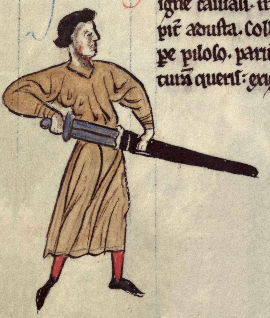
Drawing of de Lacy by Gerald of Wales

King John’s Castle, also known as Carlingford Castle, played a role in 500 years of Irish history from medieval times to the Battle of the Boyne.

Carlingford Castle is located in a strategic position on a high rocky outcrop point above Carlingford’s harbor on the south side of Carlingford Lough.

The original section of the castle, its west wing, was built in the late 12th century by Hugh de De Lacy, Lord of Meath, shortly after the Norman invasion of Ireland. De Lacy was a wealthy and powerful Anglo-Norman landowner and royal office-holder.

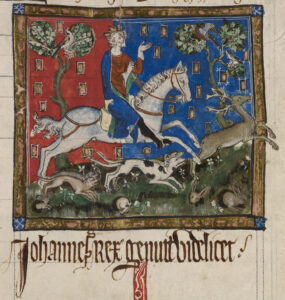
 King John hunting a stag with hounds.

King John hunting a stag with hounds.

De Lacy accompanied King Henry II as part of an Anglo-Norman invasion of Ireland in October 1171.

In early 1172 De Lacy was sent accept the surrender of Rory, the last High King of Ireland prior to the Anglo-Norman invasion. Before King Henry returned to England around the end of March 1172, De Lacy was granted authority over Meath and was given command of Dublin Castle.

The catch for De Lacy was he had to gain control of the portions of Ireland that Henry had granted to him. In an effort to control eastern Ireland, De Lacy began building a series of castles, including Trim Castle in Meath, Kilkea Castle, and a mott-and-baily structure in Clandard in County Meath.

Returning to England in late 1172, De Lacy was involved in a dispute with Archbishop of Canterbury Richard of Dover and in 1173 he led in an unsuccessful battle in France during fighting with French King Louis VII.[1]

De Lacy returned to Ireland as procurator-general in 1177 and quickly became a controversial figure.

As governor of Ireland De Lacy took control of both Leinster and Meath and continued building numerous castles.

De Lacy’s marriage to an Irish princess angered Henry.

De Lacy married the daughter of Ruadri O Conchobair, deposed High King of Ireland, in 1181 without asking Henry’s permission. He was recalled from his royal post because of the marriage. But he was sent back Ireland in 1182, this time with royal clerk Robert of Shrewsbury watching over him.

Henry sent his son John, the future King John, to Ireland in 1185. The prince complained to his father that De Lacy was preventing the Irish from paying tribute.

King John supposedly stayed in the castle for three days in 1210 while his army crushed a rebellion by Ireland’s Anglo-Norman lords. It then became known as King John’s castle.

Some accounts accuse De Lacy of trying rule Ireland on his own.

One account says De Lacy lost favor because of complaints of his injustice by the Irish. His mistreatment of the Irish leadership may have led to his death in 1186.

De Lacy’s murder is described in the Annals of Ulster –

“A.D. 1186. Hugo de Lacy went to Durrow to make a castle there, having a countless number of English with him; for he was king of Meath, Breifny, and Oriel, and it was to him the tribute of Connaught was paid, and he it was that won all Ireland for the English. Meath from the Shannon to the sea was full of his castles and English followers. After the completion of this work by him, i.e., the erection of the castle of Durrow, he came out to look at the castle, having three Englishmen along with him. There came then one youth of the men of Meath up to him, having his battle-axe concealed, namely Gilla-gan-inathar O’Megey, the foster son of the Fox himself (chief of Teffia), and he gave him one blow, so that he cut off his head, and he fell, both head and body, into the ditch of the castle.”

O’Megey, escaped. His motive may have been revenge for seizures of land by De Lacy, according to Alfred Webb’s A Compendium of Irish Biography, published in 1878.

In 1326 control of the castle was given to Geoffrey le Blound, then to Edmond Loundres in 1388, and Stephen Gernon in 1400. Henry MacShane O’Neill attempted to capture the castle in 1596.

The castle was held by the Irish Catholic Confederation during the Irish Confederate Wars 1641 to 1653. Sir Henry Tichborne, (Parliamentarian) gained control of the castle in 1642, then by Murrough O’Brien in 1649 and Charles Coote in 1650.

Jacobites fired on the castle in 1689 during the Williamite War. It was used as a Williamite hospital prior to the Battle of the Boyne.[2][3]

[1] Kingsford, Charles Lethbridge (1892). “Lacy, Hugh de (d.1186)”. In Lee, Sidney (ed.). Dictionary of National Biography. Vol. 31. London: Smith, Elder & Co.
[2] “Castles.nl – Carlingford Castle”, https://www.castles.nl/carlingford-castle.
[3] “Castle works progress – Independent.ie”, https://www.independent.ie/regionals/argus/news/castle-works-progress-31177882.html.
Four Masters, Annals of Ireland by the: Translated and Edited by John O’Donovan. 7 vols. Dublin, 1856.
Giraldus Cambrensis: Topography, and History of the Conquest in Ireland: Forester and Wright. London, 1863.
Music: Far Over The Highlands, Christopher Moe Ditievsen; The Norman Kings, Bonnie Grace

#ireland #irish #IrishHistory #irishcastle #history #carlingford #CountyLouth #englishhistory

Bunratty Castle and Folk Park: Top Irish Tourist Destination

Brunratty Castle and Folk Park

#irish #castle #irishhistory #bunratty #countyclare #ireland

Bunratty Castle is a large 15th-century tower house in County Clare, Ireland. https://www.bunrattycastle.ie/

The castle and adjoining folk park are one of Ireland’s top tourist attractions. The current structure is the forth castle to occupy the site.

This one was built by the MacNamara family after around 1425. At around 1500, Bunratty Castle came into the hands of the O’Briens (or O’Brians), dominate clan in Munster and later Earls of Thomond. They expanded the site and eventually made it their seat.

In 1720 the O’Breins sold the site. By the late 1800s the castle had fallen into disrepair. In 1956, the castle was purchased and restored by Standish Vereker, 7th Viscount Gort, with assistance from Ireland’s Office of Public Works.

Bunratty Castle opened to the public in 1960, with sporting furniture, tapestries and works of art dating to around the 1600’s.

A folk park, preserving traditional Irish homes, from the humblest to the most prosperous, has been developed on the 240 acres around the castle.

Today the property is run by Shannon Heritage a company that also operates tourist attractions Craggaunowen – The Living Past Experience, Co Clare, Knappogue – Co Clare, Dunguaire Castle, Co Galway. https://www.shannonheritage.com/about…

Buy Me A Coffee https://www.buymeacoffee.com/rdscallyN

Marconi Was Irish

Guglielmo Marconi was IRISH.

Irish!? Wait.

Guglielmo Marconi. One of the most famous Italians of modern times. How could he be Irish?

OK. Guglielmo Marconi was HALF Irish.

Marconi’s mother was Anne Jameson. Annie Jameson of Daphne Castle in County Wexford, Ireland. She was a granddaughter of John Jameson, founder of whiskey distillers Jameson & Sons.

Marconi was born into the Italian nobility.

Annie Jameson was an aspiring opera singer. She travelled to Italy to study.
She met and married widower Giuseppe Marconi, an Italian aristocrat, while in Italy.

Guglielmo Giovanni Maria Marcon was born 25 April 1874 in Bologna, Italy. Living at Villa Griffone, near Bologna,.

Guglielmo Marconi was educated at home by a series of tutors. He spent time Ireland as youth and as child lived in England for about four years with his mother.
https://www.vaticannews.va/en/world/n…

While teenager, Marconi began working on ‘wireless telegraphy’.

Summer of 1895, Guglielmo, 21, made his first wireless over land transmission of 3 kilometers at Villa Griffone.

And radio was born.

Italy uninterested in Marconi’s work.

But England was.

In 1896 he traveled to London.

Sir William Preece, the chief electrical engineer of the British Post Office, supported Marconi’s work.Soon it was being tested by engineers

In 1987, Marconi made his first wireless transmission over the sea.

A test between Ballycastle and Rathlin Island off the County Antrim coast for insurance company Lloyds of London took place In 1898. This was the first commercial wireless telegraph transmission.

At the turn of the 20th century, Marconi began investigating sending transatlantic wireless messages to compete with the undersea telegraph cables.

Marconi set up wireless transmitting stations in Ireland and Canada to compete with transatlantic telegraph cables.

Marconi established a wireless transmitting station at Marconi House, Rosslare Strand, County Wexford, in 1901 to act as a link between Poldhu in Cornwall, England, and Clifden in Connemara, County Galway, Ireland.

Regular transatlantic radio-telegraph service begun on 17 October 1907 between Clifden, Co. Galway, Ireland, and Glace Bay.

Marconi won the Nobel Prize for physics in 1909.

The first trans-Atlantic wireless telephone conversation between Ballybunion, Co. Kerry and Louisburg, Nova Scotia took place in 1919.

On 17 December 1902, a transmission from Marconi’s station in Glace Bay, Nova Scotia, Canada, became the first radio message to cross the Atlantic from North America to Europe.

Marconi and his wireless are credited with the rescue of the 706 survivors of the Titanic’s sinking. The Titanic’s radio operators – Harold Bride and Jack Philips – were Marconi Company employees. Radio contact with the Cunard liner the Carpathia led to the rescue of the Titanic survivors.

Bride survived the Titanic disaster but was badly injured. Philips, the wireless operator on duty the night of the sinking, did not.

Marconi had been offered free passage on Titanic’s maiden voyage. But he had taken the Lusitania, which would be sunk by German U-boats in 1915, to New York.

Marconi also had another personal connection to Ireland.

While in England, he met Beatrice O’Brien (1882–1976), a daughter of Edward Donough O’Brien, the 14th Baron Inchiquin.

Beatrice O’Brien and Marconi were married 16 March 1905. They had three daughters and a son.

The Marconi family returned to Italy In 1913, joining Rome’s high society. Beatrice became a lady-in-waiting to Queen Elena.

Marconi and Beatrice divorced in 1924. Marconi had the marriage annulled in 1927 so he could remarry in the Catholic Church.

Marconi joined the joined the Italian Fascist party in 1923, just as the party rose to power.

Fascist dictator Benito Mussolini, who used radio to spread the Fascist message, was Marconi’s best man when he married Maria Cristina Bezzi-Scali in 1927.

In 1930, Mussolini made Marconi president of the Royal Academy of Italy, and a member of the Fascist Grand Council. Marconi was an advocate of fascist ideology.

He personally ensured that Jews were not appointed to the scientific society during his time as president. https://www.theguardian.com/world/200…

In 1937, while developing microwave technology, Marconi had a series of nine heart attacks.

He died in Rome on 20 July 1937, age 63.

Marconi’s remains are interred in an elaborate mausoleum adjacent to the 17th-century Villa Griffone/Villa Marconi, located in Pontecchio Marconi, outside Bologna in Emilia Romagna, Italy.

He didn’t not look like it or act like it. But Marconi was half Irish.

Spanish Armada Wreck On Streedagh Beach, Co. Sligo, Ireland

Spanish Armada Wreck At Streedagh Beach

On 21 September 1588, three damaged vessels of the Spanish Armada were blown ashore during a violent storm on Streedagh Beach in what is now County Sligo, Ireland.

The three ships were carracks, armed merchant ships.

The three ships were the La Lavia (25 guns), a Venetian merchantman and the vice-flagship; La Juliana (32 guns) a Catalan merchantman; and Santa Maria de Vison (de Biscione) (18 guns) a Ragusan merchantmen.

The ships were 3 of 28 from the Spanish Armada, part of an unsuccessful attempt to invade England, that had fled to the Irish coastline after the invasion plan collapsed in August 1588. The three ships retreated to the west coast of Ireland and were anchored about a mile offshore when a major storm began.

On 21 September, the ships’ anchor cables gave way in heavy seas. When the storm began on 17 September all three ships were already in serious trouble.All three were heavily damaged from battle in the English channel.

All three had cut their main anchors to flee the English fleet when the battle of Battle of Gravelines began.

Having no main anchors made anchoring near to shore difficult. When the ships hit the shore, they broke apart in less than hour.

Accounts differ by about 1,800 men drowned, according to an account by Captain Francisco de Cuellar, one of the few survivors.

Approximately 300 made it ashore.“ ..and not being able to weather round or double Cape Clear, in Ireland, on account of the severe storm which arose upon the bow, he was forced to make for the land with these three ships, which, as I say, were of the largest size, and to anchor more than half a league from the shore, where we remained for four days without being able to make any provision, nor could it even be made.

On the fifth day there sprang up so great a storm on our beam, with a sea up to the heavens, so that the cables could not hold nor the sails serve us, and we were driven ashore with all three ships upon a beach, covered with very fine sand, shut in on one side and the other by great rocks. The likes of this had never been seen for, within the hour, our three ships broke up completely, with less than three hundred men surviving.

Over a thousand drowned among them many important people, captains, gentlemen and regular officers….many men drowned inside the ships, while others jumped into the water never to come up again.” — Captain Francisco de Cuellar
https://babel.hathitrust.org/cgi/pt?i…

Once ashore, most of the survivors were attacked by locals and robbed of everything, including their clothes, or they were attacked by English soldiers and slaughtered. De Cuellar managed to survive a number of encounters with robbers and the English.The late sixteenth century. and 1588 in particular, was marked by unusually strong North Atlantic storms.

Most of the 28 Spanish ships lost in the storms were along the jagged steep rocks of the western coast of Ireland.

About 5,000 men died by drowning, starvation and slaughter by local inhabitants after their ships were driven ashore on the west coasts of Scotland and Ireland.

English soldiers in Ireland were ordered to kill any Spanish prisoners, England’s Lord Deputy William FitzWilliam instead of asking for ransom as was common during that period.

The locations of the wrecks were discovered in 1985.

https://www.youtube.com/watch?v=nqCs-… and some other artifacts were recovered in 2015. https://www.youtube.com/watch?v=kOyas… The local community commemorates the event each year on the third weekend in September. https://www.youtube.com/watch?v=Mj5jx… Armada In Irelandhttps://spanisharmadaireland.com/

Who Is Buried in Yeats’ Grave?

William Butler Yeats, renowned Irish poet, playwright and writer, winner of the 1923 Nobel Prize for literature, is buried in St. Columba’s church graveyard in Drumcliff (sometimes spelled Drumcliffe) in County Sligo, Ireland.

Or is he?

Yeats died at the Hôtel Idéal Séjour, in Menton, France, on 28 January 1939. He was 73.[1] Yeats was buried at Roquebrune-Cap-Martin following a discreet and private funeral.

But Yeats’s family wanted him buried in Ireland, in the graveyard of the neo-Gothic style St. Columba’s, where his great grandfather had been rector.

Attempts were made in France to dissuade the family from relocating the remains to Ireland due to the uncertainty of their identity.
Yeats’s body was exhumed in 1946 and transferred to the cemetery’s ossuary and mixed with other remains.[2] French Foreign Ministry authorities were worried about the fact that Yeats’ remains were thrown into a communal grave.[7]

Yeats’ wish was that he be buried quickly in France. According to his wife, George, “His actual words were ‘If I die, bury me up there [at Roquebrune] and then in a year’s time when the newspapers have forgotten me, dig me up and plant me in Sligo’.”[3]

Positively identified or not, in September 1948, nine years after his death, Yeats’s remains were moved to the graveyard of St Columba’s.[4]
The remains buried in Drumcliff, Co. Sligo, may – or may not – be those of William Butler Yeats.

The man in charge of repatriating the poet’s remains for the Irish Government was Seán MacBride, Minister of External Affairs, the son of Maud Gonne MacBride, who was one of Yeats’s former lovers. [5][6]

Yeats married 25-year-old Georgie Hyde-Lees, known as George, in 1917. He was 51. Despite their age difference and Yeats’ affairs with other women, the couple remained married. They had two children, Anne and Michael. Georgie once wrote to her husband “When you are dead, people will talk about your love affairs, but I shall say nothing, for I will remember how proud you were.”

The epitaph carved into Yeats’s tombstone in Drumcliff is from “one of his final poems Under Ben Bulben”:

Cast a cold Eye
On Life, on Death
Horseman, pass by!

1. Obituary. “W. B. Yeats Dead Archived 28 September 2013 at the Wayback Machine”. The New York Times, 30 January 1939. 2. Jordan, Anthony J. (2003). W. B. Yeats: Vain, Glorious, Lout – A Maker of Modern Ireland. Westport Books. ISBN 978-0-9524447-2-5.3. Foster, R. F. (2003). 3. W. B. Yeats: A Life. Vol. II: The Arch-Poet 1915–1939. Oxford University Press. ISBN 978-0-19-818465-2. 4. Foster, 2003
5. Jordon, 20036.
6. Cahill, Christopher (December 2003). “Second Puberty: The Later Years of W. B. Yeats Brought His Best Poetry, along with personal melodrama on an epic scale”. theatlantic.com. Archived from the original on 29 August 2021. 7. “The Documents”. The Irish Times. Archived from the original on 9 November 2017.

Exploring Mizen Head and Barley Cove Beach

Mizen Head and Barley Cove Beach

Mizen Head and Barley Cove Beach – Wild Atlantic Way, Southwest Co, Cork, Ireland.

Mizen Head in County Cork along the Wild Atlantic Way, is often called the most southwesterly place in the Republic of Ireland.It’s not.

That honor actually belongs to Brow Head, a location nearby that is 9 more meters further southwest and located 3.8 km east of Mizen Head.

But it is Mizen Head, specifically the Mizen Head Signal Station, that is the major tourist destination. It is as far southwest as most tourists in Ireland will get.

The Mizen Head Signal Station – a former light house and radio beacon station for mariners and commercial shipping – has become a top-stop major tourist destination along the southern portion of the Wild Atlantic Way.

In 1992 the manned signal station and its crew were replaced with an automated beacon.A local tourism cooperative, the Mizen Tourism Co-operative Society, acquired the signal station site and buildings from The Commissioners of Irish Lights, Ireland’s light house authority. The property included a large section of Wild Atlantic Way scenic coastal palisades.

Using local and European Union funding, the tourism group created walkways that feature a spectacular bridge, a viewing platform, developed a visitor’s center and began charging admission for access to the walkways and viewing area.Mizen Head Signal Station quickly caught on as must-see for tourists visiting the County Cork portion of the Wild Atlantic Way.
https://mizenhead.ie/

Opening TimesJune, July and August
Daily 10am – 6pm
September, October, April, May
Daily 10:30am – 5pm

November – March Weekends 11am – 4pm

Entry PricesAdult: €7.50 | Senior/Student: €6Child under 14: €4.50 | Child under 5: Free

Group & Family DealsFamily (2 Adults and up to 4 Children): €25Groups (10 and over): Adults: €6.50 | Senior/Student: €5 | Child 5-14: €3.50
https://mizenhead.ie/about-mizen/

Accessibility

Accessibility for wheelchair users is good in the Mizen Head Signal Station visitor’s center. However, anyone with mobility issues should be very cautious on the walkways, especially when the weather is less than ideal.

The venue itself says to budget at least 1.5 hours for a visit using the walks ways to view the cliffs.Your experience at the Mizen Head will vary with the wildly varying Irish weather.

Thick fog and rain moved in during our Mizen Head visit in September 2022, reducing visibility to zero and making a €7.50 trip down the walkway unattractive.

However, the view from area immediately outside the visitor’s center is quite spectacular, as is the drive to the visitor’s center, even if you do not or cannot access the cliff-side walkway.

Near Mizen Head on the Mizen Peninsula to the south is Barley Cove Beach.

The beach is one of several Special Areas of Conservation in Ireland under the European Union’s Habitats Directive, due to the variety of wildlife and habitats in the sand dunes.
http://www.westcorkweb.ie/barleycove/

The wide beach and the bay it faces are popular in the summer.Barley Cove’s delicate dunes and an adjacent shallow lake were born in relatively recent times. An earthquake and tsunami on 1 November 1755 caused 15-foot waves at Barley Cove displacing the sand that created the dunes, the Cork Journal newspaper reported on 2 November 1755.

The same earthquake and tsunami destroyed Lisbon, Portugal.

Barley Cove Beach is a sheltered, south facing beach popular with swimmers and surfers. Lifeguards are on duty only during the summer months with dates and times displayed on the noticeboard on the beach.Barley Cove Beach, however, is on the Wild Atlantic way. Swimmers take extreme care due to dangerous currents and rip tides – especially during the off season.

Accessibility

Accessibility for wheel chair users is limited here. Boardwalks cross the sand dunes and a floating bridge, in use only in the summer months, connect to more dunes and the beach to the north of the main parking area.There is also beach access on the opposite side of the bay near the Barleycove Beach Hotel.
https://barleycovebeachhotel.com/