Ireland Inside and Out
Featured
20

Located in a bend of the River Boyne in County Meath, Ireland, Brú na Bóinne (“mansion or palace of the Boyne”) is also called the Boyne Valley tombs.
Brú na Bóinne is an ancient monument complex and ritual landscape built during the 32nd century BCE.
The site is dominated by the passage tombs of Dowth (Dubhadh), Knowth (Cnogbha) and Newgrange (Sí an Bhrú).
Brú na Bóinne is one of the world’s most important Neolithic landscapes, and is a UNESCO Wolrd Heritage site. Collectively it consists of at least ninety monuments including passage tombs, burial mounds, standing stones and enclosures. It is the largest assemblage of megalithic art in Europe.
The archaeological culture associated with is called the “Boyne culture,” of which little is known. The Boyne valley has been a center of human settlement for at least 6,000 years. Most of the major structures date from the Neolithic period to around 5,000 years ago.
Predating the Egyptian pyramids, the site is a complex of Neolithic mounds, chamber tombs, standing stones, henges and other prehistoric enclosures. The site covers 780 ha (1,927 acres). Brú na Bóinne is located eight kilometers west of Drogheda in County Meath, Ireland, in a bend of the River Boyne, about 40 kilometers north of Dublin. It contains about 40 passage tombs, as well as other prehistoric sites and features built later.
Brú na Bóinne is also an important archaeoastronomical site. Several of the passage tombs are aligned with the winter solstice and equinoxes. The site’s construction is sophisticated, showing a knowledge of science and astronomy, which is especially evident in the winter solstice-aligned passage grave of Newgrange.
Most of the monuments are on the north side of the river Boyne. Each of main tombs stand on a ridge within the river bend. Dowth, Knowth, and Newgrange may have been built to be visible from each other and from northern and southern approaches along the Boyne.
Two of the tombs, Knowth and Newgrange, appear to contain stones re-used from an earlier monument at the site, there is no evidence for earlier activity at the site, except for a few finds of flint tools from Mesolithic hunters.
Work on the tombs and other features by the original Boyne culture appears to have stopped around 2,900 BCE.
The area was ritual and ceremonial site in the later Bronze Age and Iron Age, long after the Boyne culture that built the tombs had disappeared. The area was used until the early Bronze Age, when a number of embanked, pit and wooden post circles (collectively referred to as “henges”) were built. Artifacts from the later Bronze Age include some cist and ring ditch burials and burnt mounds. From the Iron Age there is only evidence of sporadic activity, such as burials near Knowth and at Rosnaree. Valuable items from the Roman period such as coins and jewelry were found near Newgrange
In Irish mythology, the tombs are considered portals to the Otherworld and the homes of the deities, The Dagda and his son Aengus.
The Brú na Bóinne began was first studied by antiquarians in the 18th century. Archaeological excavations began in the 20th century, when some of the passage tombs – Knowth and Newgrange – underwent restoration.
St. Mary’s Church, Mansfieldstown is a medieval church and National Monument in County Louth, Ireland.
Mansfieldstown Church is located 3.7 km (2.3 mi) west of Castlebellingham, on the north bank of the River Glyde.
The earliest reference to a church here is in the Papal Registers of 1299. Archbishop Richard FitzRalph delivered a sermon at Mansfieldstown in 1349, in the midst of the Black Death. The church was recorded as ruined in 1640.
The confusingly named Mansfieldstown Old Church was built in 1691, after the Battle of the Boyne.
The church currently is in ruins. The church incorporates a 15th-century Late Gothic east window. The Late Gothic east window has tracery, stones bars or ribs, that help support glass.
There were many alterations and additions made in the 19th century.
The graveyard surrounding the ruined church has a mixture of very old and more recent burials.
A large, decorated, c. 15th-century baptismal font once stood here. The baptismal font it is now in another church names for St. Mary, St. Mary’s Parish Church, in nearby Ardee. St. Mary’s in Ardee Built was circa 1810 on the site of an earlier church.
During the Black Death, in 1349, Archbishop Richard FitzRalph delivered a sermon at Mansfieldstown.
Mansfieldtown, the townland name, is derived from the Anglo-Norman Maundeville family who settled there after 1172.
The Jumping Wall at Kildemock Church is located just outside the town of Ardee in Co. Louth, Ireland.
The stone west wall of the ruined church is said to “jumped” about three feet (a little less than a meter) off its foundation yet remained upright although a slight titled angle.
Shrouded in local mythology, the story of the jumping wall involves either the weather or paranormal activity.
One story has it that the wall moved during a powerful storm in February 1715. The other legend has it that the wall moved away from a grave located a few feet outside the wall of a man who had been excommunicated from the church.
A plaque on the wall states: “This wall by its pitch, tilt and position can be seen to have moved three feet from its foundation. Contemporary accounts mention a severe storm in 1715 when the wall was lifted and deposited as it now stands but local tradition states that the wall jumped inwards to exclude the grave of an excommunicated person.
Another explanation is the wall’s movement is a hoax and the twin tales were spun to attract pilgrims and tourists to the site. Some sources downplay the idea of a hoax because skilled craftsman would have been needed to create the wall. The gable wall is about 19 feet high, 15 feet wide (17 meters long and 7 meters wide) and three feet thick.
The Kildemock church and its surrounding graveyard are ancient.
Excavations and restoration took place at the site about 70 years ago. In 1953-54 archaeologists in 1953-54 removed centuries accumulated debris and the true outline of the church became apparent, as did the “jumping” wall. According to one report, in 1953, fragments of a stained glass window, lead and a silver penny with Edward III’s likeness stamped on it were recovered. Edward III was king of England January 1327 until his death in 1377.
A bullaun stone is located at the north entrance to the church. A medieval cross grave slab is located near the southwest corner of the structure.
The ancient Church of Deomog once stood on this site, according to the Visions of the Past website. https://visionsofthepastblog.com/2013… It is believed a disciple of St. Patrick and St. Benen founded the early Christian church that stood on the site.
After the Norman invasion of Ireland in the 12th century, the parish came under the control of the Knights Templar, and this church was built in the early 14th century in honor of St Catherine.
The church remained under the control of the Knights Templar until the order was suppressed in 1312 when ownership passed to the Knights Hospitallers until Henry VIII’s religious suppression of the 1540s. When the church fell into ruins is unknown, though one of the grave slabs in the church is dated 1688.
The graveyard around the church ruins appears to have been in continuous use hundreds of years, and there are number of tombstones and grave markers where names and dates have completely eroded away. The graveyard is still in use today.
Regardless of the myths surrounding the wall, the site is a beautiful, contemplative place.
No one seems in a hurry to dispel any of the myths surrounding the “jumping” wall and the site does indeed attract curious visitors.
#ireland #irish #irishhistory #countylouth #ancientireland #jumpingchurch #jumpingwall
Dowth is one of the three main tombs of the Brú na Bóinne World Heritage Site – a landscape of prehistoric monuments including the large passage-tombs at nearby Newgrange and Knowth.
Dowth, Knowth and Newgrange are actually all part of single ancient ritual landscape, rather than separate sites.
Unlike Newgrange and Knowth, Dowth has not been independently dated and has not undergone extensive restoration.
Dowth is less developed as a tourist attraction than Knowth and Newgrange, partly because the site has been damaged by centuries of looters, plundered by Vikings, and had stones taken by quarrying. Ill-advised archeological work in the 19th century included the Royal Irish Academy dynamiting the roof, causing a large still visible crater.
Dowth is set in a spectacular location on the highest point in the Boyne Valley. Newgrange, 2 kilometers distant, is visible from Dowth.
Dowth’s mound is approximately 15 meters high and 85 meters in diameter. It one of the largest and oldest megalithic structures in Ireland, larger than Newgrange.
http://www.carrowkeel.com/sites/boyne/dowth1.html
White quartz stones found around the base of the Dowth mound indicate it may once have had a bright white exterior wall like Newgrange.
Dowth was once surrounded by 115 kerbstones. Kerbstone 51, known as the Stone of the Seven Suns, features a number of radial circular carvings. A kerbstone with cup-marks and a spiral and a flower-like design, marks the entrance to Dowth South.
Three stone-lined passages lead into the mound. There are two passage tombs, known as Dowth North and Dowth South, and a souterrain. A third entrance on Dowth’s west side of is an early Christian souterrain that leads into the passage of Dowth North. It was built during the 10th or 11th century CE.
Like the other Boyne Valley passage tombs, Dowth has a rich mythological history.
According to one legend, Dowth is the burial place of the goddess Boann. Boann was said to have created the River Boyne.
Dowth was also believed to be the entrance to the Otherworld, a magical realm that was home to the Tuatha Dé Danann, mythical gods who lived in Ireland before humans.
In legendary lore, Dowth is called the Fairy Mound of Darkness, Dubhadh (‘darkening’), and The House of Darkness.
The medieval Dindsenchas (lore of places) says that king Bresal Bó-Díbad ordered the construction of a tower in a single day to reach heaven. Bersal’s sister cast a spell, making the sun stand still so that one day lasted indefinitely. Bresal then committed incest with his sister, breaking the spell, a legend similar to one associated with Newgrange.
With the spell broken, the sun sets and the builders leave. Hence the name Dubhadh (‘darkening’).
There may be a kernel of fact in the incest myth. Recent DNA analysis of human remains of a man at found Newgrange revealed he had parents who were most likely siblings.
These tales of light and darkness have been linked with solstice alignments at Brú na Bóinne.
Dowth’s tombs have winter solstice solar alignments like Newgrange.
Martin Brennan, author of The Stars and the Stones: Ancient Art and Astronomy in discovered the alignment during a ten-year study of the Boyne Valley.
From November to February light from the evening sun reaches into the Dowth South tomb passage and into the chamber. During the winter solstice, the sun light moves along the passage, into the circular chamber, where three stones are lit up by the sun.
https://www.knowth.com/dowth-sunsets.htm
Music:
Newgrange, RDScally & the Obstweedles, from the album Entropy: The Last Word In Everything
Available on Bandcamp
https://obstweedles.bandcamp.com/track/newgrange
ASCAP: QZ-6V5-16-00148 Published by Wounded Weasel Music Copyright 2019
Clouds Obscura, RDScally & the Obstweedles, from the album Entropy: The Last Word In Everything
Available on Bandcamp https://obstweedles.bandcamp.com/track/clouds-obscura
ASCAP: QZ-6V5-16-00156 Published by Wounded Weasel Music Copyright 2019
Entropy: The Last Word In Everything
https://obstweedles.bandcamp.com/album/entropy-the-last-word-in-everything
Published by Wounded Weasel Music Copyright 2019
#Dowth #ireland #irish #irishhistory #ancientireland #countymeath #passagetomb #archeology #irisharcheology #newgrange #knowth #ireland_travel #megalithic #kerbstone #runes
The passage tomb at Newgrange is Ireland’s most famous megalithic monument.
Newgrange, located on hillside overlooking the River Boyne, 8 kilometers (5.0 mi) west of Drogheda, is a passage tomb built during the Neolithic Period, around 3200 BC. It is older than Stonehenge and the Egyptian pyramids.
Newgrange is the main monument in the Brú na Bóinne complex, a World Heritage Site that includes the nearby passage tombs of Knowth and Dowth, as well as other henges, burial mounds and standing stones.
Newgrange consists of a large circular mound with an inner stone passageway that leads to a cruciform chamber. Burnt and unburnt human bones, and possible grave goods or votive offerings, were found in this chamber.
The mound has a retaining wall at the front, made mostly of white quartz cobblestones. It is encircled by kerbstones, with many of the stones engraved in megalithic art. The mound is also ringed by a stone circle.
Some of the material that makes up the monument came from as far as the Mournes and Wicklow Mountains.
There is no agreement about the Newgrange tomb’s purpose, but it is believed it had religious significance.
It is aligned on the winter solstice sunrise so that the rising sun shines through a ‘roofbox’ above the entrance and floods the inner chamber with sunlight.
The engineering and construction of the roofbox and tomb indicates a highly sophisticated ancient culture existed in Boyne River valley.
Archeologists disagree about the construction of the Newgrange tomb.
Irish geologist and naturalist Frank Mitchell, who studied Newgrange, suggested that it could have been built in as little as five years. His estimate was based on the likely number of local inhabitants during the Neolithic age and the amount of time they could have devoted to building it rather than farming.
Mitchell’s estimate, however, was challenged by archeologist Michael J. O’Kelly and his archaeological team, who believed that it would have taken a minimum of thirty years to build.
DNA analysis revealed that bones found in the most chamber belonged to a man whose parents were first-degree relatives, possibly brother and sister. Such inbreeding was usually only found in royal dynasties headed by ‘god-kings’, such as the pharaohs of ancient Egypt, who married among themselves to keep the royal bloodline ‘pure’. The man was distantly related to people buried in the Carrowkeel and Carrowmore tombs.
This, together with the prestige of the burial, could mean that an elite group was responsible for building Newgrange.
The largely unknown Boyne valley culture used the site for about 1,000 years. The site then feel into ruins but area remained in use by the Beaker Culture, another group that replaced the culture that built the passage tomb, into the Bronze Age.
During the Bronze Age large timber circle (or henge) was constructed to the southeast of the main mound and a smaller timber circle to the west.
Newgrange evidently continued to have some ritual significance into the Iron Age. Some of the objects deposited around the mound include two pendants made from gold Roman coins of 320–337 and Roman-era gold jewelry including two bracelets, two finger rings, and a necklace. These Roman finds are interesting since the Romans did not occupy Ireland as they did Brittan and never had a long-term presence in Ireland.
Music Used in this Video:
Artist: RDScally and the Obstweedles
Song: Gardening With Candide
https://obstweedles.bandcamp.com/album/gardening-with-candide-the-optimist-grows-it-alone-jardiner-avec-candide
Album: Gardening With Candide
QZ-6V5-16-00175 ASCAP
Copyright 2020 RDScally / Wounded Weasel Publishing
Available from Bandcamp
https://obstweedles.bandcamp.com/track/gardening-with-candide
Many of these castles are historic ruins, but a few have been restored and are still in use.
At least three County Louth castles – Belllingham Castle, Darver Castle and Slane Castle – are wedding and event venues. Another – Smarmore Castle – is a drug and alcohol dependency treatment facility. Ardee Castle houses municipal government offices.
A few castles, such as Castle Roche, are on private land. Others, such as Carlingford (King John’s) Castle, The Mint in Carlingford and Roodstown Castle, are designated Irish national monuments.
This video covers just some of Louth’s prominent castles and isn’t comprehensive.
A full listing of Louth’s castles:
Rootsweb.com The Castles of Ireland
https://sites.rootsweb.com/~irlkik/ihm/castles/irecastl-Louth.htm
#ireland #irish #irishhistory #irishcastle #louth #countylouth #history #castles #irishcastles #carlingford #cúchulainn #roodstown #ardee #irishcastles #castleroche #carlingfordcastle #middleages #medieval #medievalreland #englishhistory #england #thepale
Castle Roche is a Norman castle was the seat of the de Verdun family who built the castle in 1236 AD. [1]
Located 10 km (7 miles) northwest of Dundalk, County Louth, Ireland, Castle Roche is located on a large and steep-sided rocky outcrop with a commanding view of the surrounding area.
A deep moat and thick walls rendered it virtually impregnable. A secret passage may have once connected the castle to a round tower outpost.
The castle’s layout is nearly triangular with a large central courtyard inside the walls. A bailey separated from the castle to the north controlled entrance to the castle and the bridge between its two large bastion towers.
Although ruined the internal layout of the castle is visible, with a two- or three-story hall in the south sections along with remains other structures.
Castle Roche held a strategic position on the border between the then Gaelic province of Ulster, and the Anglo-Norman territory known as The Pale. The castle controlled the pass into what is now South Armagh.
Castle Roche was known as ‘Castellum de Rupe’ or ‘Castle on the Rock’ due to its strategic location. The de Verdun family owned the site for four centuries. Nicholas de Verdun (who died in 1316), a younger brother of Theobald II de Verdun, was in charge during the Bruce Invasion by Edward Bruce, brother of Robert the Bruce.
A gathering of English forces in Ireland took place here in 1561. The castle was ruined in 1641, during the Oliver Cromwell’s conquest of Ireland.
A Guide (With Warnings) For Visiting Castle Roche Near Dundalk https://www.theirishroadtrip.com/cast… Sources and credits: De Verdun family history https://web.archive.org/web/201603031… Castle Roche photo Creative Commons, by Hazazzy, uploaded 6 April 2010. The Majestic Ruin of Castle Roche
Cú Chulainn’s Castle, also known as Dún Dealgan Motte, Byrne’s Folly or Pirate Byrne’s Castle, represents multiple layers of Irish myth and history.
Cú Chulainn’s Castle, a designated Irish National Monument, is located northwest of Dundalk and west of Mount Avenue, on a ridge overlooking the Castletown River.
An ancient Gaelic Irish dún — or fort — once stood here. Some legends claim the site, which had a surrounding village, was the birthplace of Cú Chulainn.
The recorded reference to a fort on this site is from 1001-1002 AD.
A motte-and-bailey, the type of castle built after the Norman invasion, may have been constructed by Norman noble Bertram III de Verdun (c.1135–1192).
In 1210, it was a stronghold of Hugh de Lacy, 1st Earl of Ulster. De Lacy abandoned it when he was being hunted by England’s King John. De Lacy built and controlled several castles and fortified tower houses in County Louth, including Carlingford Castle, also known as King John’s castle.
On 14 October 1318, it was the site of the Battle of Faughart, which ended with the death of Edward Bruce, brother of Robert Bruce. Edward Bruce was drawn and quartered, his parts sent as a warning to the four corners of Ireland. His head was shipped to the King of England.
Yet, Bruce has a grave at the nearby Hill of Faughart.
Local landowner and merchant Patrick Byrne, who was often called a pirate due his involvement in smuggling, built a Gothic house with a tower on the mount in 1780. It was damaged in the 1798 Irish Rebellion.
Only the castellated tower, which became known as “Byrne’s Folly”, remains. This is the structure visible on the site today. The house was rebuilt as a country retreat in 1850 by Thomas Vesey Dawson.
The building again fell into disrepair. It was purchased by the County Louth Archaeological and Historical Society for a museum. It was further damaged during the Irish revolutionary period (1919–23) when armed men set it ablaze.
Today, the tower and surrounding ruins are an Irish national monument. In May 2023, local politicians called upon Ireland’s Department of Public Works, keepers of national monuments, to make the castle more accessible to tourists.
The site’s steep, curving driveway is blocked by an iron gate. Visitors must either climb a set of stone steps or squeeze around a small dirt path opening next to the steps to gain access to the driveway. The site is marked with an informational sign and part way up the driveway a handrail is already in place, should more tourists be able to access the site.
The castle’s main drawback as a tourist draw is the lack of parking. Parking in front of the gate is prohibited. The nearest safe parking is along one of the streets in the nearby housing estates across the street from the site.
On the sunny, breezy day we visited, we had Cú Chulainn’s Castle to ourselves.
Links, References and Sources:
■ Ask About Ireland https://www.askaboutireland.ie/readin…
■ Cu Chulainn’s Castle Dundalk Republic Of Ireland 
• CU CHULAINN’S CAS…
■ Cúchulainn’s Castle, Castletown Motte ,Co Louth , Ireland
• Cúchulainn’s Cas…
■ Dundalk Business Improvement District https://dundalktown.ie/cuchulainns-ca…
■ Irish Road Trip https://www.theirishroadtrip.com/cu-c…
■ News story: Cuchulainn’s Castle should be developed tourist attraction for Dundalk says Cllr Sean Kelly https://www.independent.ie/regionals/…
■ Megalithic Ireland http://www.megalithicireland.com/Dun%… ■ Secret Ireland https://secretireland.ie/how-are-cuch…
■ The Incredibly Long Journey https://theincrediblylongjourney.com/…
■ Visit Louth https://www.visitlouth.ie/explore-and…
■ Visions of the Past https://visionsofthepastblog.com/2015… ■ Books ➤Crowl, Philip Axtell (1 January 1990). The Intelligent Traveller’s Guide to Historic Ireland. Contemporary Books. ISBN 9780809240623 https://books.google.com/books?id=hKG… ➤Hagger, Mark S. (1 January 2001). The Fortunes of a Norman Family: The de Verduns in England, Ireland and Wales, 1066-1316. Four Courts Press. ISBN 9781851825967 https://books.google.com/books?id=hVJ…
■ See our website for more info: https://irelandinsideandout.com/ #Ireland #Irish #IrishHistory #Dundalk #CountyLouth #CúChulainn #castle #Irishcastles #mythicalIreland #castles #middleages #BattleofFaughart
Clochafarmore is a standing stone and National Monument in County Louth, Ireland.
This standing stone is traditionally associated with the death in battle of the mythical hero CúChulainn.
Legend has it CúChulainn was killed here. As he was dying, CúChulainn tied himself to the stone so he could face his enemies, continuing to fight even as he died.
This field has become known locally as the “Field of Slaughter”.
In the 1920s, a bronze spearhead was found near the stone. Unfortunately, the spearhead was given to parish priest and not a museum and has since been lost.
CúChulainn’s Stone (or Clochafarmore) stands 3 meters, 10 feet, tall and approximately 1.3 meters, 5 feet wide.
The phallic stone itself was likely erected in the Bronze Age, 1000 BC and 500 AD. There is little hard evidence of its origin, early use or cultural significance.
This monument pre-dates the Iron Age legend of CúChulainn. The legend told today likely represents an attempt to interpret an existing, ancient landscape. The name Clochafarmore comes from the Irish Cloch an Fhir Mhóir, meaning “Stone of the Big Man”. The field where it is located is known locally as “The Field of Slaughter”.
On that day we visited the Field of Slaughter was planted with potatoes that were awaiting harvest.
One odd feature of the stone is name, Jim McKenna, and the date 1912 that has been chiseled vertically on one side of the stone. Who McKenna was and why is name was carved into the stone is not explained in any of the source materials on this stone, although there are mentions of it.
On the day we visited a hurling stick has been left at the base of the stone. McKenna may have been an early 20th century champion hurler from County Louth.
If you have any information about who McKenna was, please tell us in the comments.
Although the standing stone is in a private farm field, there is an information sign and stile entrance allowing access to the site of the national monument. Entering the field does require a small climb to clear the stile.
Clochafarmore Standing Stone, Co. Louth
Nearest Town: Knockbridge
Townland: Rathiddy
GPS coordinates:
Latitude: 53° 58′ 28.25″ N
Longitude: 6° 27′ 57.18 W
Links and sources:
Curious Ireland
https://curiousireland.ie/cuchulainn-…
It’s My Ireland – YouTube channel:
• Clochafarmore Sta…
Megalithic Ireland website –
http://www.megalithicireland.com/Cloc…
Voice From The Dawn website:
https://voicesfromthedawn.com/clochaf…
Google Maps location:
https://www.google.com/maps/d/viewer?…
King John’s Castle, also known as Carlingford Castle, played a role in 500 years of Irish history from medieval times to the Battle of the Boyne.
Carlingford Castle is located in a strategic position on a high rocky outcrop point above Carlingford’s harbor on the south side of Carlingford Lough.
The original section of the castle, its west wing, was built in the late 12th century by Hugh de De Lacy, Lord of Meath, shortly after the Norman invasion of Ireland. De Lacy was a wealthy and powerful Anglo-Norman landowner and royal office-holder.
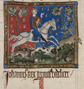
King John hunting a stag with hounds.
De Lacy accompanied King Henry II as part of an Anglo-Norman invasion of Ireland in October 1171.
In early 1172 De Lacy was sent accept the surrender of Rory, the last High King of Ireland prior to the Anglo-Norman invasion. Before King Henry returned to England around the end of March 1172, De Lacy was granted authority over Meath and was given command of Dublin Castle.
The catch for De Lacy was he had to gain control of the portions of Ireland that Henry had granted to him. In an effort to control eastern Ireland, De Lacy began building a series of castles, including Trim Castle in Meath, Kilkea Castle, and a mott-and-baily structure in Clandard in County Meath.
Returning to England in late 1172, De Lacy was involved in a dispute with Archbishop of Canterbury Richard of Dover and in 1173 he led in an unsuccessful battle in France during fighting with French King Louis VII.[1]
De Lacy returned to Ireland as procurator-general in 1177 and quickly became a controversial figure.
As governor of Ireland De Lacy took control of both Leinster and Meath and continued building numerous castles.
De Lacy’s marriage to an Irish princess angered Henry.
De Lacy married the daughter of Ruadri O Conchobair, deposed High King of Ireland, in 1181 without asking Henry’s permission. He was recalled from his royal post because of the marriage. But he was sent back Ireland in 1182, this time with royal clerk Robert of Shrewsbury watching over him.
Henry sent his son John, the future King John, to Ireland in 1185. The prince complained to his father that De Lacy was preventing the Irish from paying tribute.
King John supposedly stayed in the castle for three days in 1210 while his army crushed a rebellion by Ireland’s Anglo-Norman lords. It then became known as King John’s castle.
Some accounts accuse De Lacy of trying rule Ireland on his own.
One account says De Lacy lost favor because of complaints of his injustice by the Irish. His mistreatment of the Irish leadership may have led to his death in 1186.
De Lacy’s murder is described in the Annals of Ulster –
“A.D. 1186. Hugo de Lacy went to Durrow to make a castle there, having a countless number of English with him; for he was king of Meath, Breifny, and Oriel, and it was to him the tribute of Connaught was paid, and he it was that won all Ireland for the English. Meath from the Shannon to the sea was full of his castles and English followers. After the completion of this work by him, i.e., the erection of the castle of Durrow, he came out to look at the castle, having three Englishmen along with him. There came then one youth of the men of Meath up to him, having his battle-axe concealed, namely Gilla-gan-inathar O’Megey, the foster son of the Fox himself (chief of Teffia), and he gave him one blow, so that he cut off his head, and he fell, both head and body, into the ditch of the castle.”
O’Megey, escaped. His motive may have been revenge for seizures of land by De Lacy, according to Alfred Webb’s A Compendium of Irish Biography, published in 1878.
In 1326 control of the castle was given to Geoffrey le Blound, then to Edmond Loundres in 1388, and Stephen Gernon in 1400. Henry MacShane O’Neill attempted to capture the castle in 1596.
The castle was held by the Irish Catholic Confederation during the Irish Confederate Wars 1641 to 1653. Sir Henry Tichborne, (Parliamentarian) gained control of the castle in 1642, then by Murrough O’Brien in 1649 and Charles Coote in 1650.
Jacobites fired on the castle in 1689 during the Williamite War. It was used as a Williamite hospital prior to the Battle of the Boyne.[2][3]
[1] Kingsford, Charles Lethbridge (1892). “Lacy, Hugh de (d.1186)”. In Lee, Sidney (ed.). Dictionary of National Biography. Vol. 31. London: Smith, Elder & Co.
[2] “Castles.nl – Carlingford Castle”, https://www.castles.nl/carlingford-castle.
[3] “Castle works progress – Independent.ie”, https://www.independent.ie/regionals/argus/news/castle-works-progress-31177882.html.
Four Masters, Annals of Ireland by the: Translated and Edited by John O’Donovan. 7 vols. Dublin, 1856.
Giraldus Cambrensis: Topography, and History of the Conquest in Ireland: Forester and Wright. London, 1863.
Music: Far Over The Highlands, Christopher Moe Ditievsen; The Norman Kings, Bonnie Grace
#ireland #irish #IrishHistory #irishcastle #history #carlingford #CountyLouth #englishhistory

